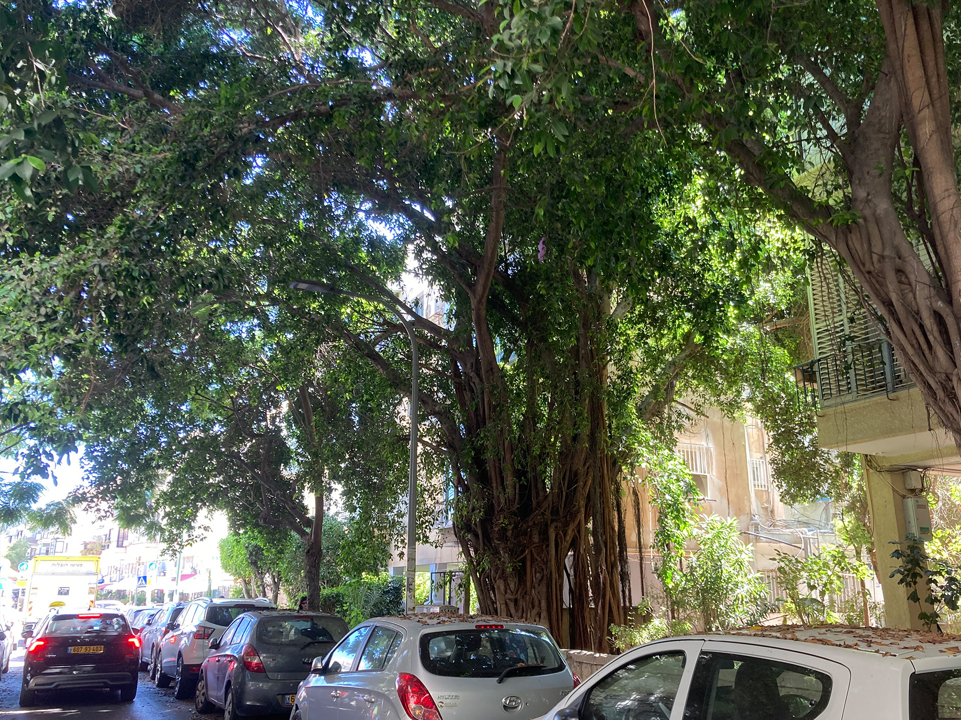
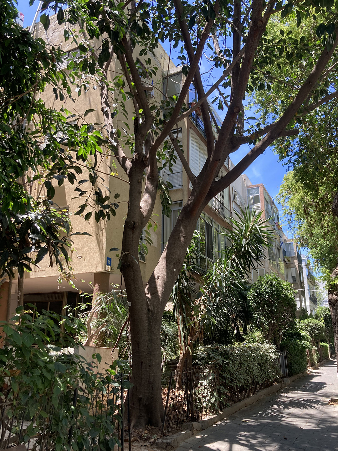
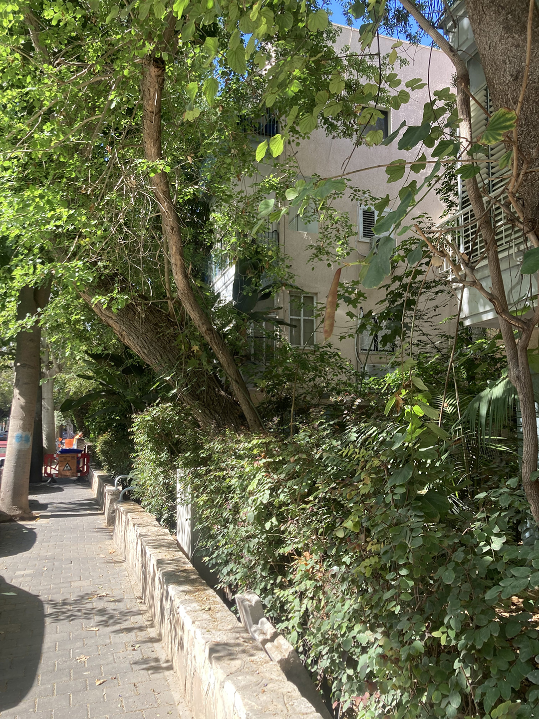
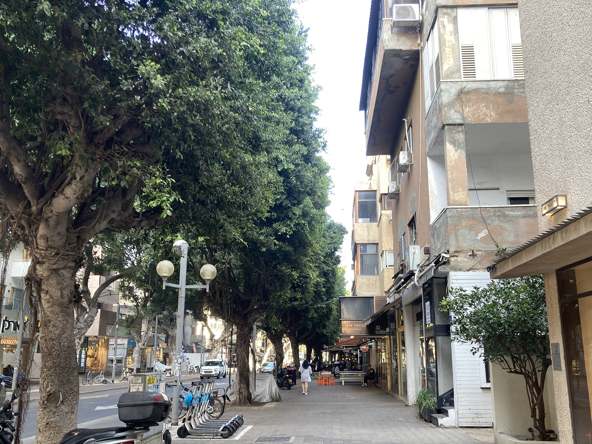
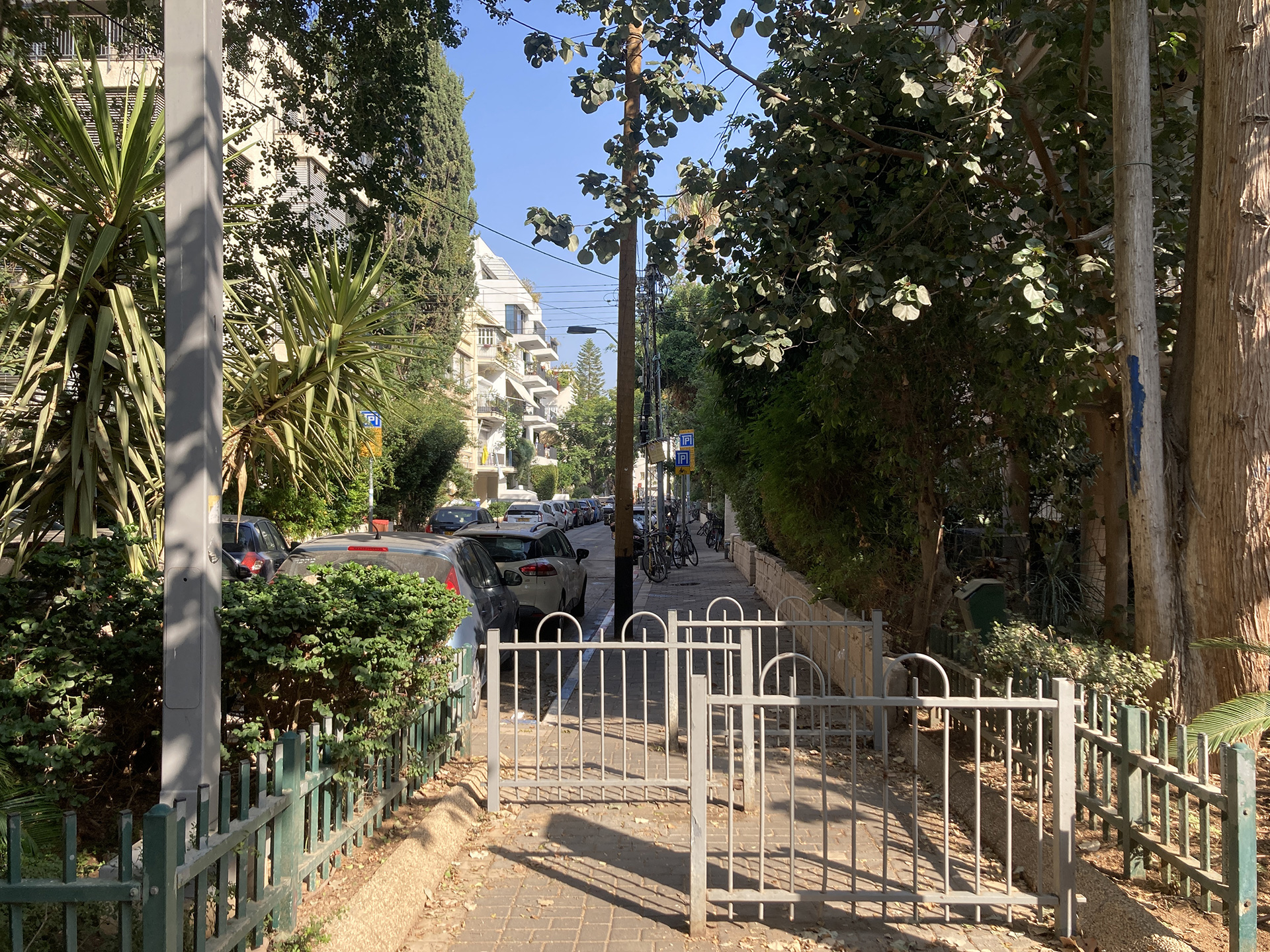
Gordon Street, Ficus Elastica on a Private Lot Forming a Civic Street Canopy, Tel Aviv, 2025.
INSPIRED BY LIVING biological systems, the Geddes Plan for Tel Aviv established a green framework for the city’s growth.
By interconnecting the leaf, the lot, the garden, the street, the boulevard, the park, and the sea, Geddes articulated a foliate master plan that gave rise to Tel Aviv’s “Civic Green,” a living, reciprocal modern garden city in which daily life is intertwined with public and private trees and greenery.
The rapid realization of Geddes’ vision was made possible by a convergence of favorable conditions:
Organized land purchases and parcelization by the Jewish National Fund and Hachsharat HaYishuv consolidated ownership and structured urban development.
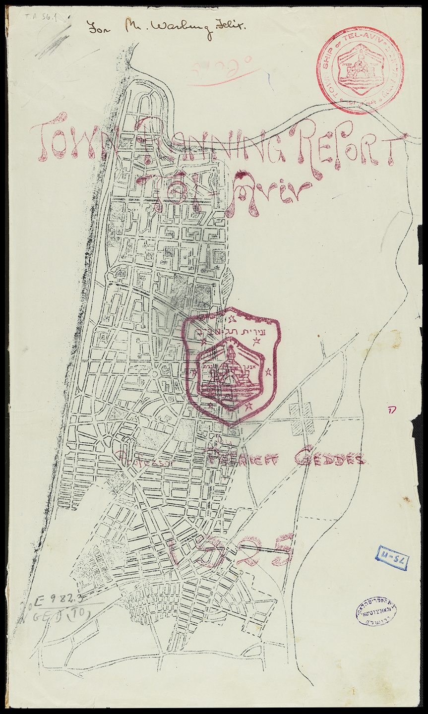
Geddes’ socially driven and pragmatic planning approach, which integrated culture, community, and environment, aligned closely with the priorities of the Zionist Commission, including Chaim Weizmann, Professor Otto Warburg, and Mayor Meir Dizengoff, who commissioned his work.
Rapid Jewish immigration following the First World War and into the interwar period, largely middle-class and urban in character, was shaped by British Mandate policies that favored immigrants with sufficient capital for land acquisition and development.
As one of the few built expressions of Geddes’ social-environmental ideas, Tel Aviv’s plan offered a non-deterministic, adaptive, and resilient environmental, garden-based, development infrastructure.
The Geddes Plan introduced a green design strategy that demonstrated competitive strength despite its small scale, provincial context, and lack of local architectural or spatial precedent.
Beyond the plan itself, Tel Aviv’s greening became a distinctly civic endeavor and a genuine public-private partnership (PPP).
Boulevards, streets, pocket neighborhood gardens, and public parks were often planned around existing trees and planted through coordinated municipal efforts, in collaboration with civic organizations.
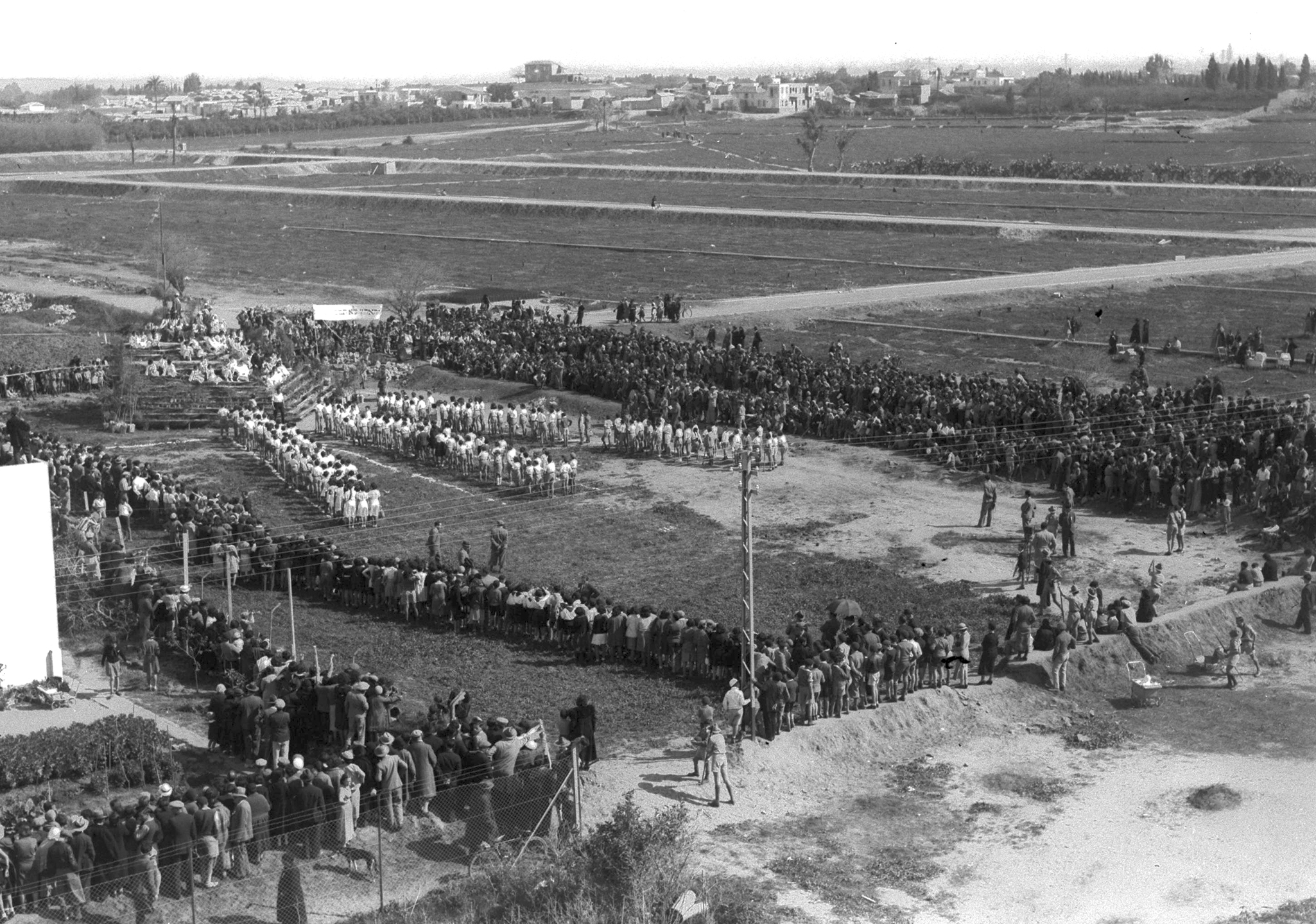
These initiatives frequently involved youth movements and schoolchildren on Tu Bishvat and were supported by the Jewish National Fund, which coordinated planting efforts across the city.
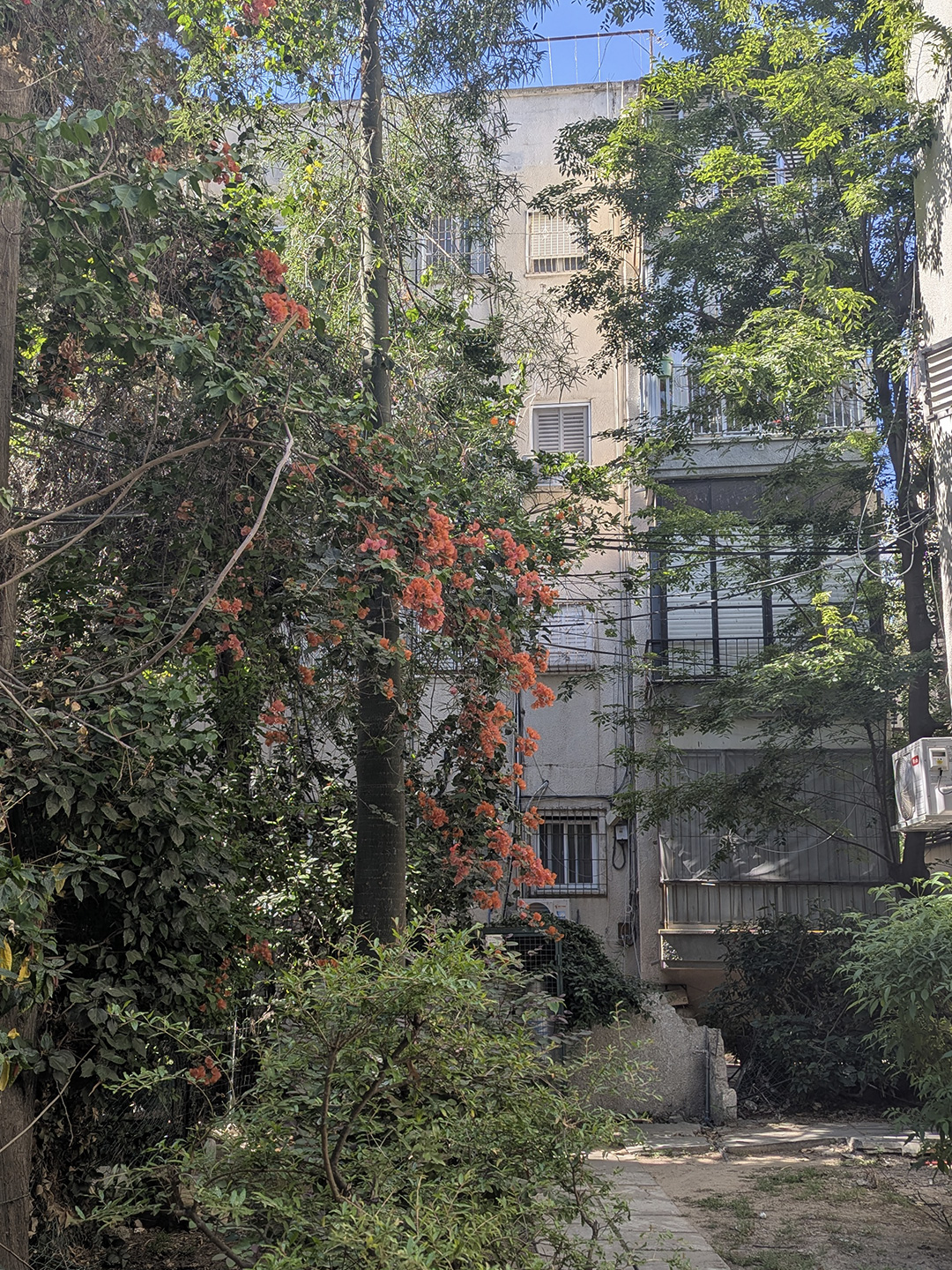
Cooperative housing organizations, schools, and civic institutions planted trees sporadically on individual lots, autonomously greening blocks, super-blocks, and neighborhoods.
These ad hoc lot gardens, literally grown from the ground up through makeshift private greening initiatives, came together into citywide plantings, making Civic Green the Geddes Plan’s most transformative legacy.
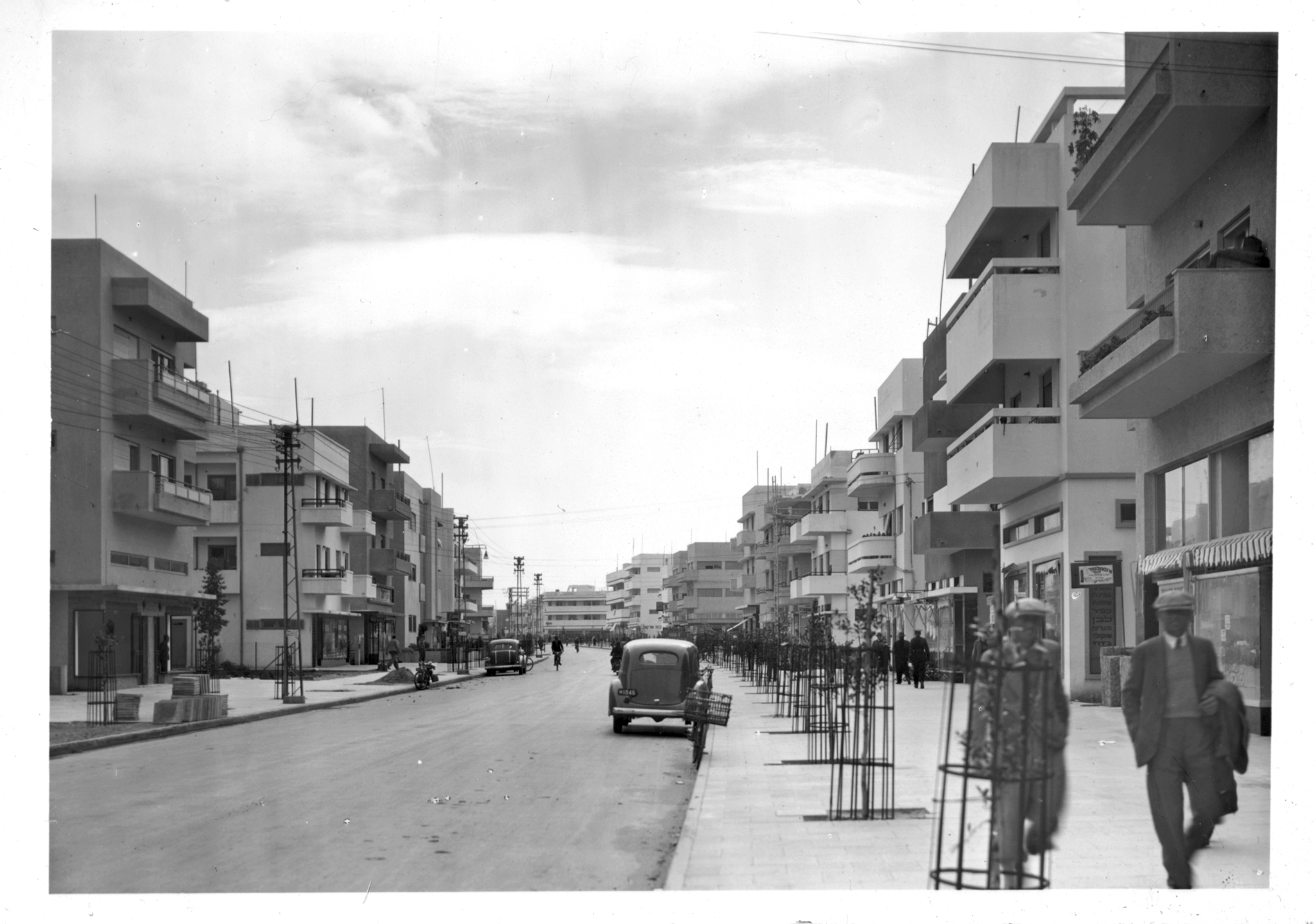
HOME GREEN: BUILT 40%, GREEN 60%. The Geddes Plan consistently utilized lots of approximately 400–500 m², yielding around 300 m² of open green space per parcel.
These regular, medium-sized plots, arranged within larger medium-density blocks and superblocks (referred to as “larger home blocks”), enabled entry-level homeownership for the city’s middle class.
Building footprints were strictly limited to one-third of each lot, whether for detached houses or for three- to five-story apartment buildings and cooperative housing that eventually spanned multiple plots.
Deep setbacks, ranging from 7 to 10 meters at the front and back and 5 meters on each side, ensured ample sunlight and natural ventilation while enabling the creation of enveloping private gardens.
At the plan’s inception, Tel Aviv was a largely barren landscape. Geddes sought to encourage every new household to become a planter, effectively transplanting the “garden village” concept into every city block.
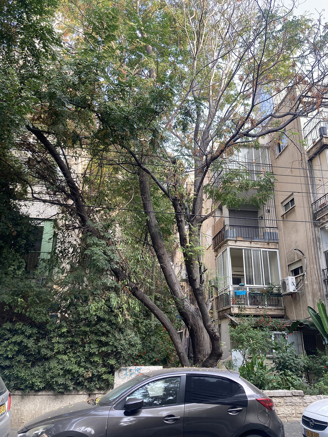
Bar Giora Street, Ficus Benjamina, Tel Aviv, 2025.
Geddes envisioned that “with its more than usually garden space around its dwellings, it can, within a very few years, become one of the most successful examples of the ‘Garden City’—a new type of civic grouping, in this respect at once more beautiful and more health-giving than any previous form of large community in human history.”
To realize this vision, the municipality distributed saplings and plants to the public. Vegetation was planted by residents themselves, as an autonomous and participatory form of green growth.
This approach effectively decentralized the labor and costs of city maintenance, transforming individual gardens into a collective urban project.
Over time, these individual lot gardens coalesced into porous blocks and superblocks, producing the interstitial and idiosyncratic green that continues to define the leafy urban fabric of Geddes’ Tel Aviv today.
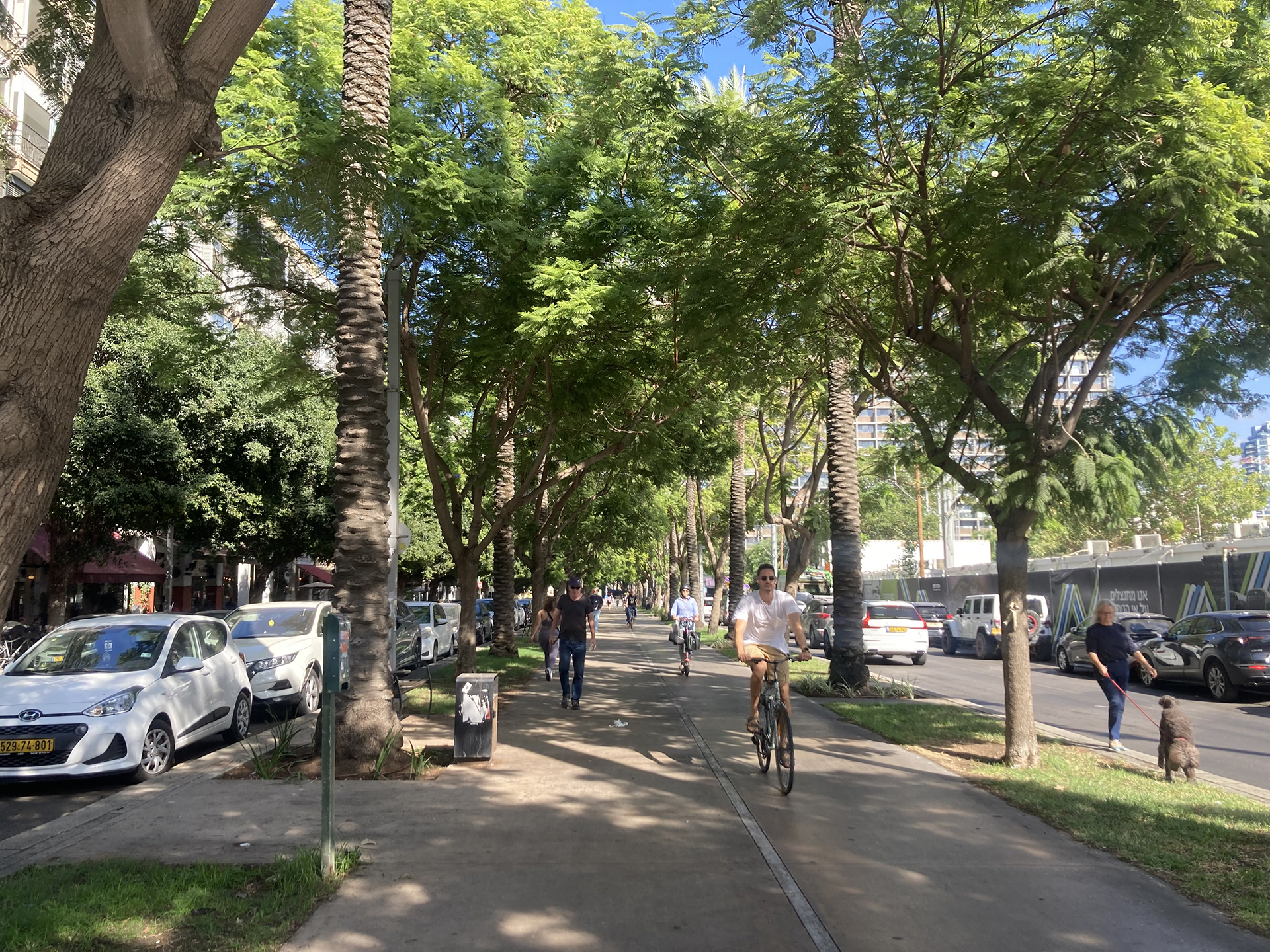
Tel Aviv–Jaffa hosts roughly 280,000 trees — 170,000 in public spaces and 110,000 on private lots, forming an integrated, living green ecosystem.
The combined tree canopy shades the city’s streets and creates a microclimate that cools temperatures by 4–5 °C degrees, reduces heat loads and thermal radiation, sustains habitats for urban arboreal species, improves walkability, quality of life, and public health.
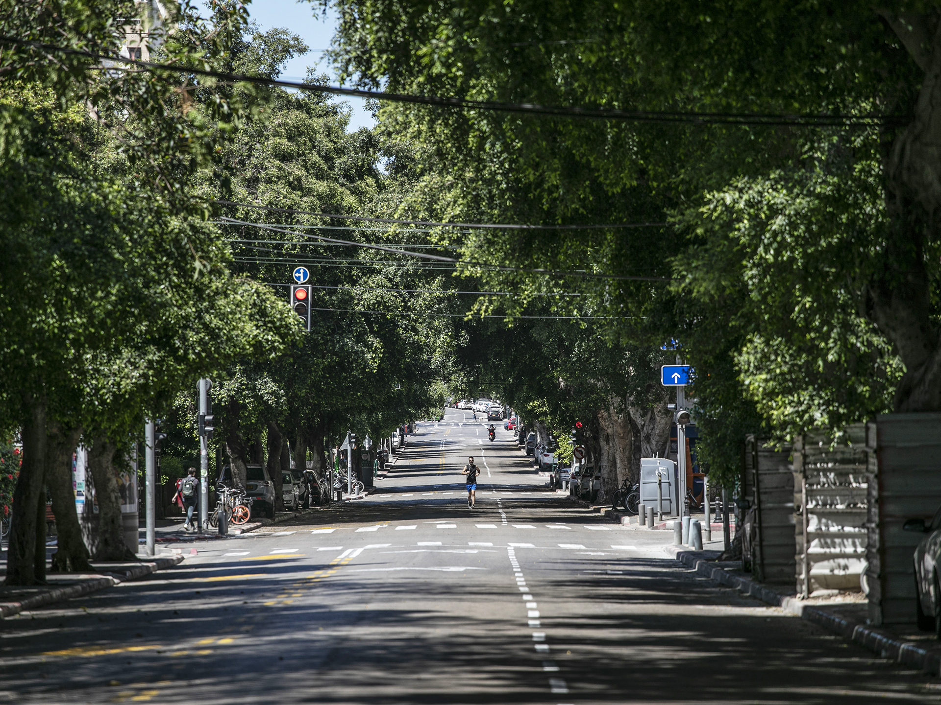
Frishman Street, Covid19 Lockdown, 2020, Dizengof 2025, Tel Aviv.
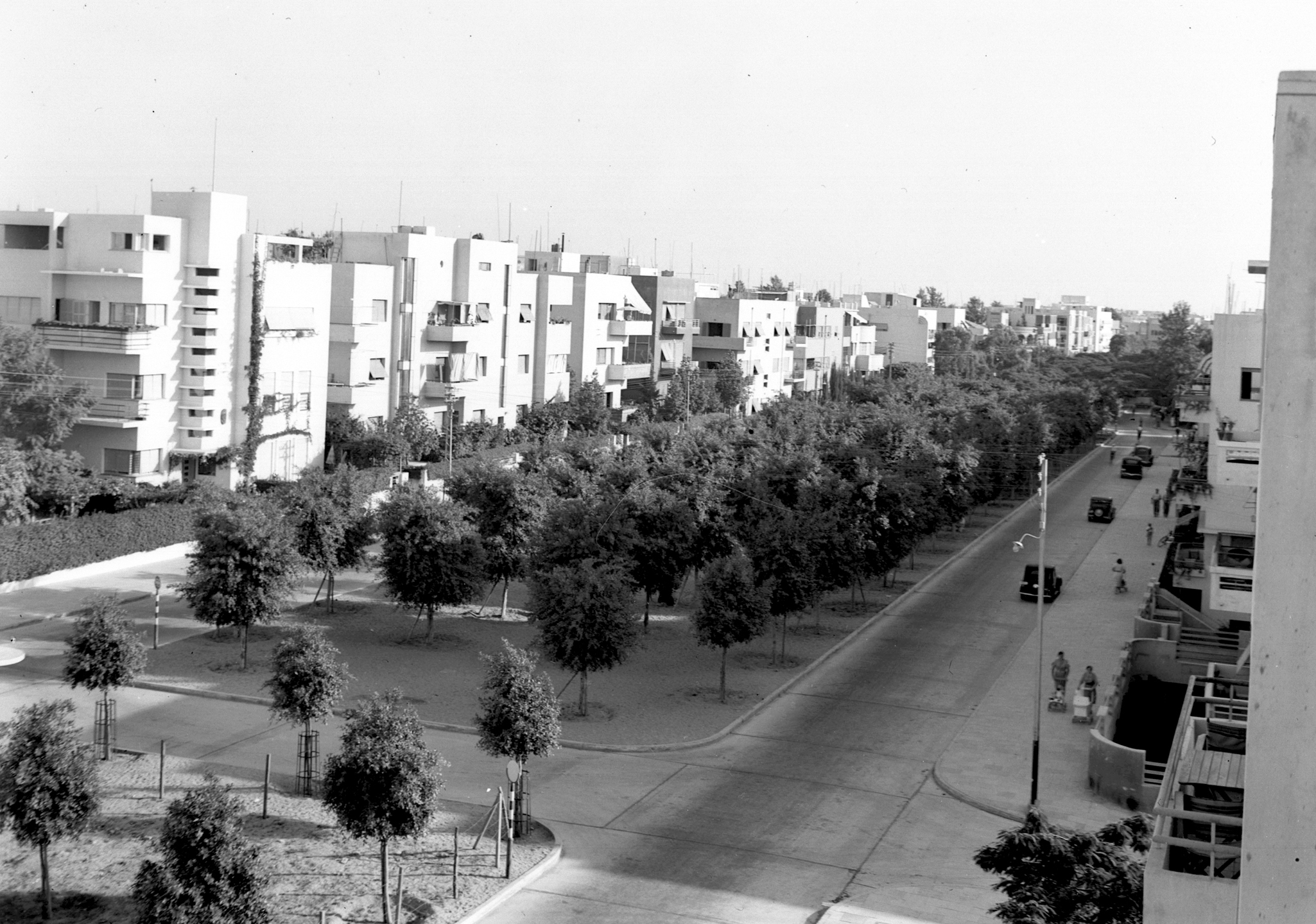
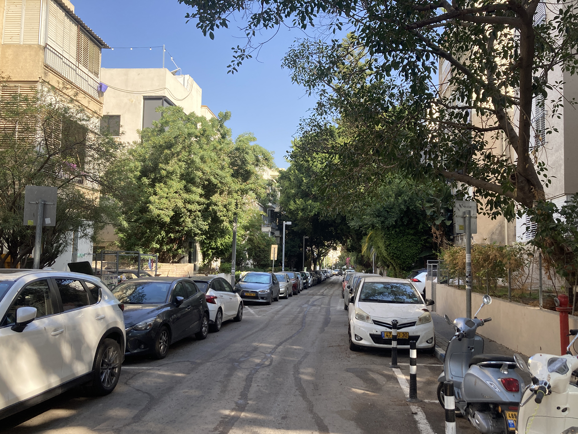
GREEN STREETS, CIVIC CANOPY: The Geddes Plan laid out seven north–south axes parallel to the sea and ten east–west streets, forming a rectilinear grid of 300-meter superblocks.
Within these superblocks, slow, non-through streets branch off the main grid, creating a pinwheel pattern of interior block passages.
By overlaying grid and spine, Geddes’ street system functions as a spatial pacemaker, organizing movement and shaping urban rhythm.
The grid axes along the perimeter of each superblock facilitate continuous movement, encouraging mixed-use commercial, residential, and transportation functions, as well as spatial orientation.
Inside the superblock, free of through traffic, the pace slows, fostering residential neighborliness.
Geddes envisioned a productive “Fruit-Garden City with almonds, citrus, olives, fig trees, and mulberry vines” (for silk production) as a progressive tree-planting strategy aimed at domestic economy, well-being, and verdant idealism in practice.
His vision was informed by Professor Otto Warburg, a leading botanist and founder of the Agricultural Experiment Station in Tel Aviv, later known as the Volcani Institute prior to its relocation to Rehovot.
Through nursery research and acclimatization trials, the station identified street tree species, including poinciana, ficus, and various citrus trees, capable of thriving in Tel Aviv’s harsh, sandy coastal soils with minimal irrigation.
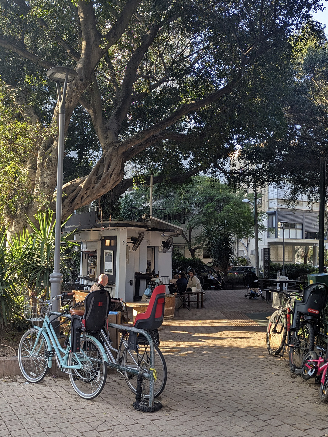
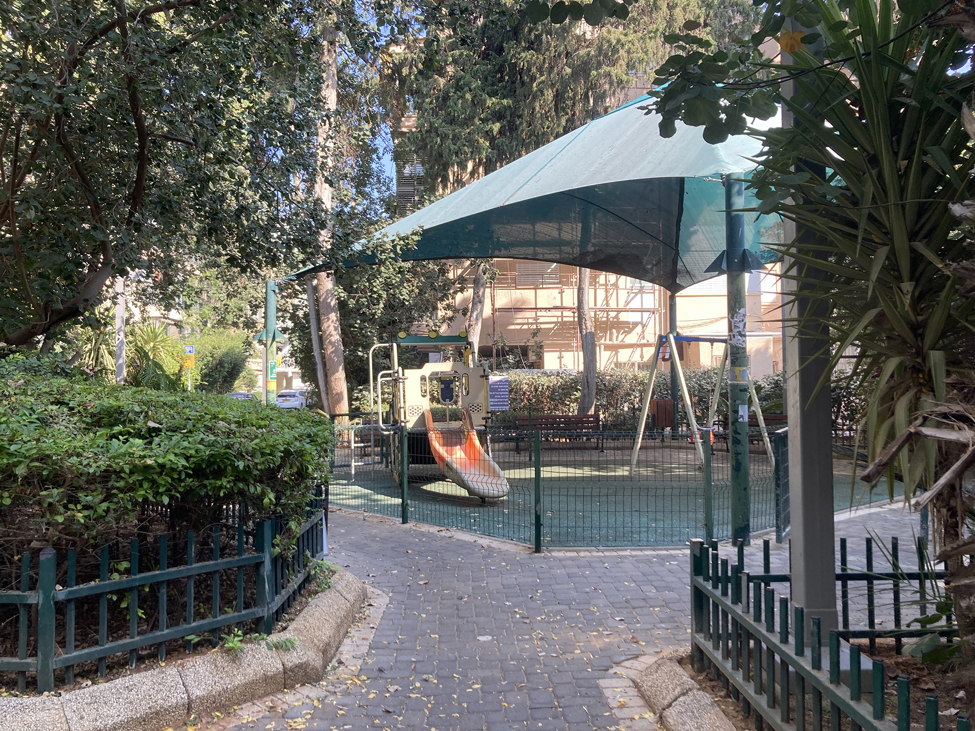
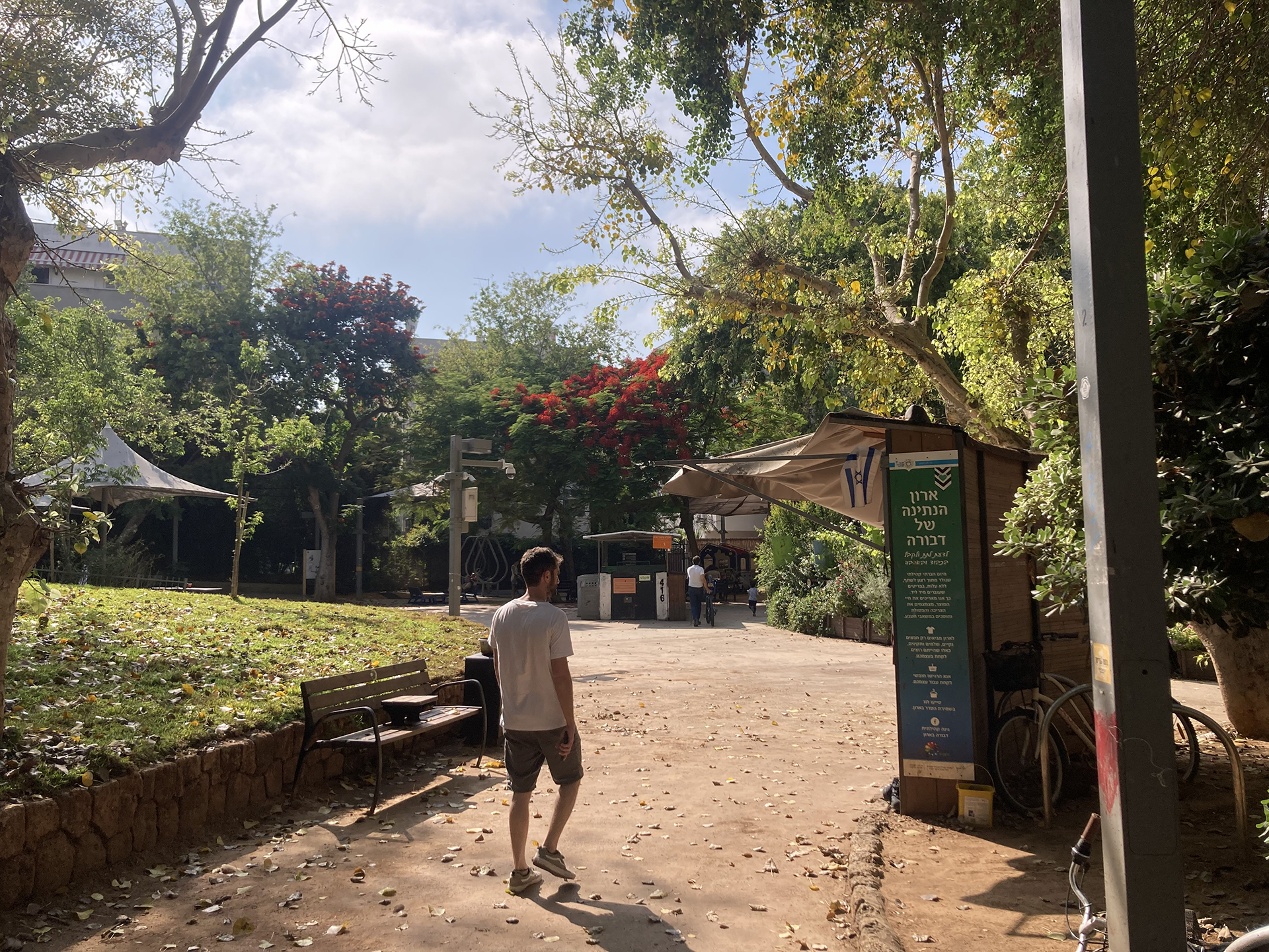
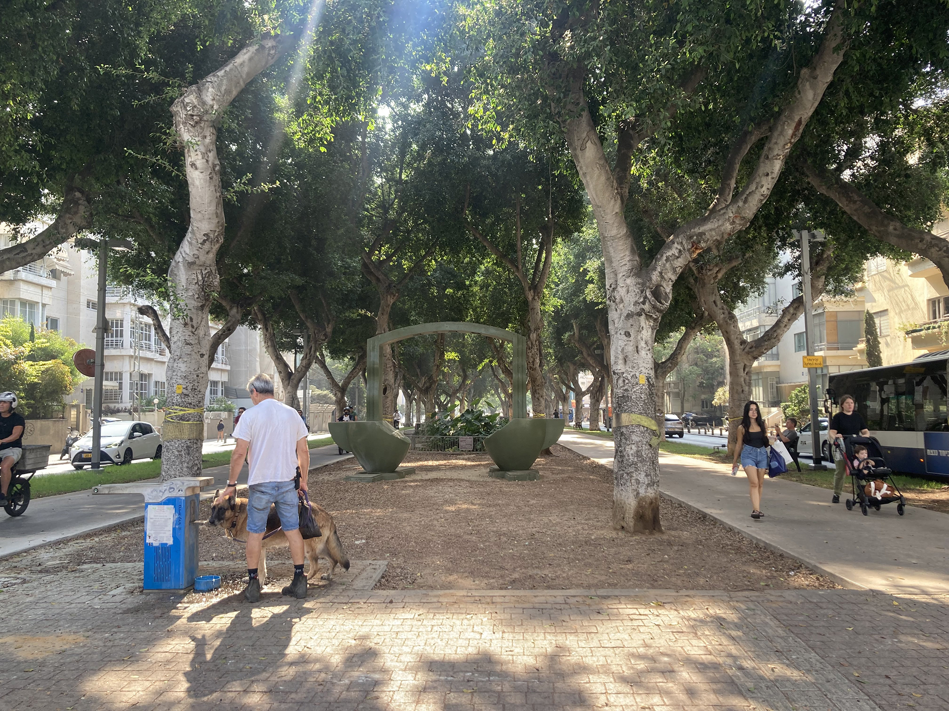
GEDDES GARDENS, GREEN POCKETS: Within the Geddes Plan, 60 public parcels were allocated inside superblocks as allotment gardens and shared green spaces.
Interspersed across the urban fabric, these local neighborhood spaces were intended to form a network of distinctive gardens, each with different plantings and cultivation practices. Together, they created variety across neighborhoods while promoting food growing, contact with nature, social encounter, and community life.
Following the municipality’s bankruptcy in 1926, only 30 of these gardens were actually developed, accounting for roughly 3–10% of the area of a typical superblock.
Geddes’ gardens continue to function as informal urban respites: some retain their original character, while others have been adapted into playgrounds, dog parks, outdoor café spaces, swap-and-share areas, and neighborhood community food gardens.
Malkhi Yisrael Boulevard, Jacaranda trees, Tel Aviv, 2025.
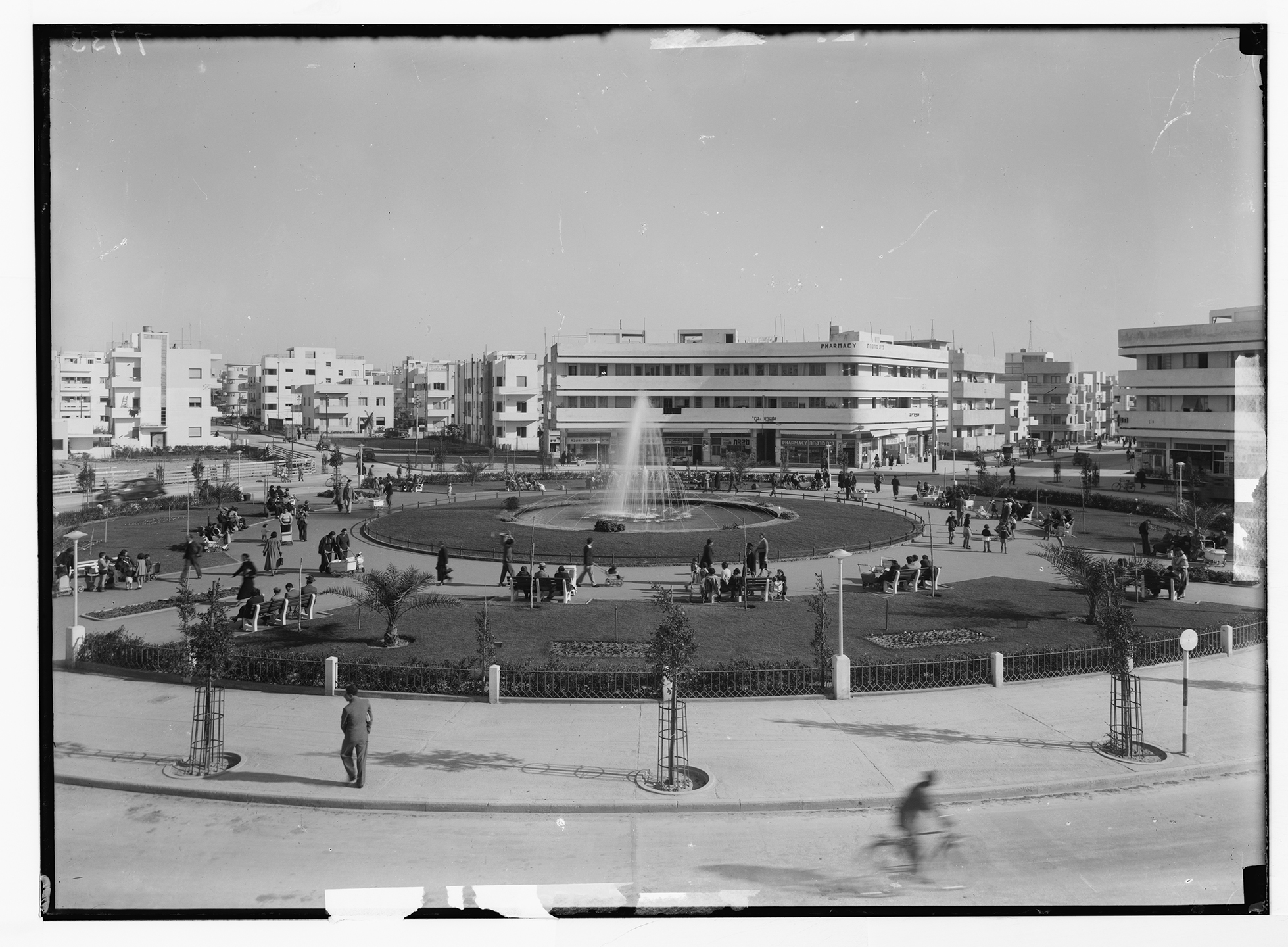
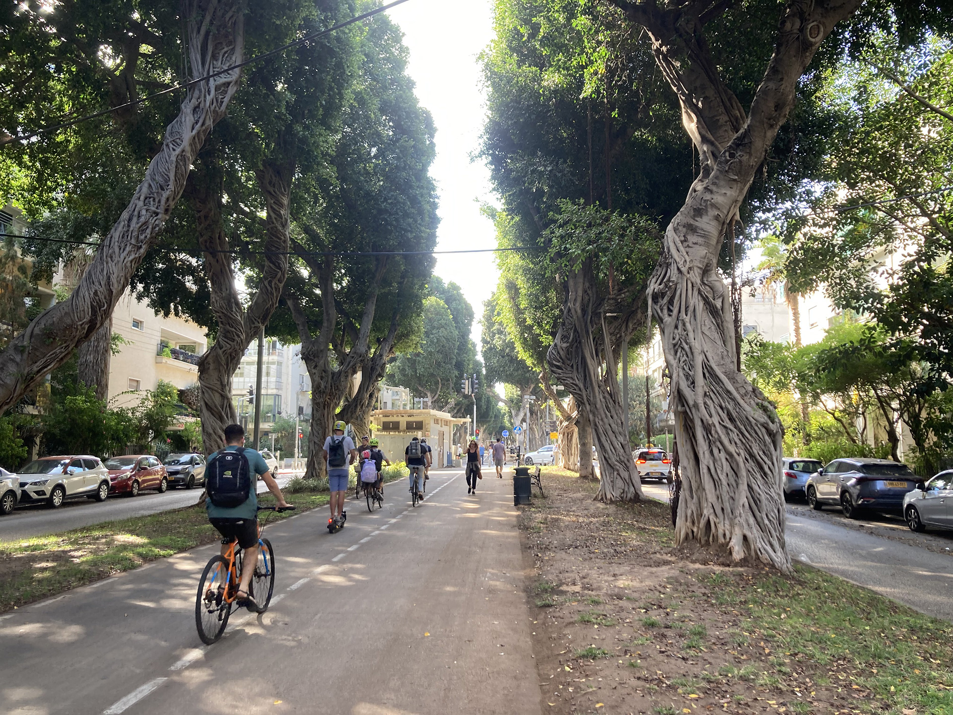
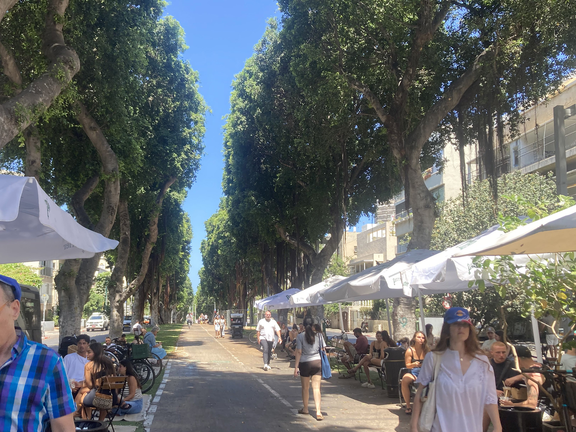
GEDDES BOULEVARDS, GREEN CIRCUITS TO THE SEA: Geddes’ five boulevards—Rothschild, Hen, Ben Zion, Ben Gurion, and Nordau—form Tel Aviv’s civic green circuit, arcing from Ahuzat Bayit, with perpendicular offshoots linking key cultural and municipal nodes (Heichal HaTarbut, Rabin Square, Kikar Atarim) to the sea, with Dizengoff Circle as a notable exception.
The boulevard system, starting with Rothschild, evolved through successive planting cycles shaped by botanical knowledge, environmental conditions, and municipal capacities. In the 1910s and 1920s, palms and acacia served as symbolic markers and stabilized the dunes.
Between 1925 and 1940, poinciana and sycamore formed the Geddes/Warburg shade canopy, with each section functioning as a sequence of different botanical gardens. From the 1950s to the 1980s, ficus trees provided dense, evergreen urban cooling.
In the 1990s, heritage trees such as ficus and poinciana were preserved and supplemented by Tipuana tipu. From the 2010s to today, a focus on ecological diversity has combined these legacy trees with newer species, including Celtis (hackberry) and various oaks, better adapted to contemporary urban conditions.
Tree-lined and shaded, these boulevards create a continuous green network, collectively experienced as spaces of civic awareness, orientation, and everyday movement.
In the late 1990s, the promenades were refurbished, replacing calcareous sand with calcareous concrete and grass. In the 2010s, they were further adapted as part of the city’s municipal cycling network, adding a new layer of micro-mobility.
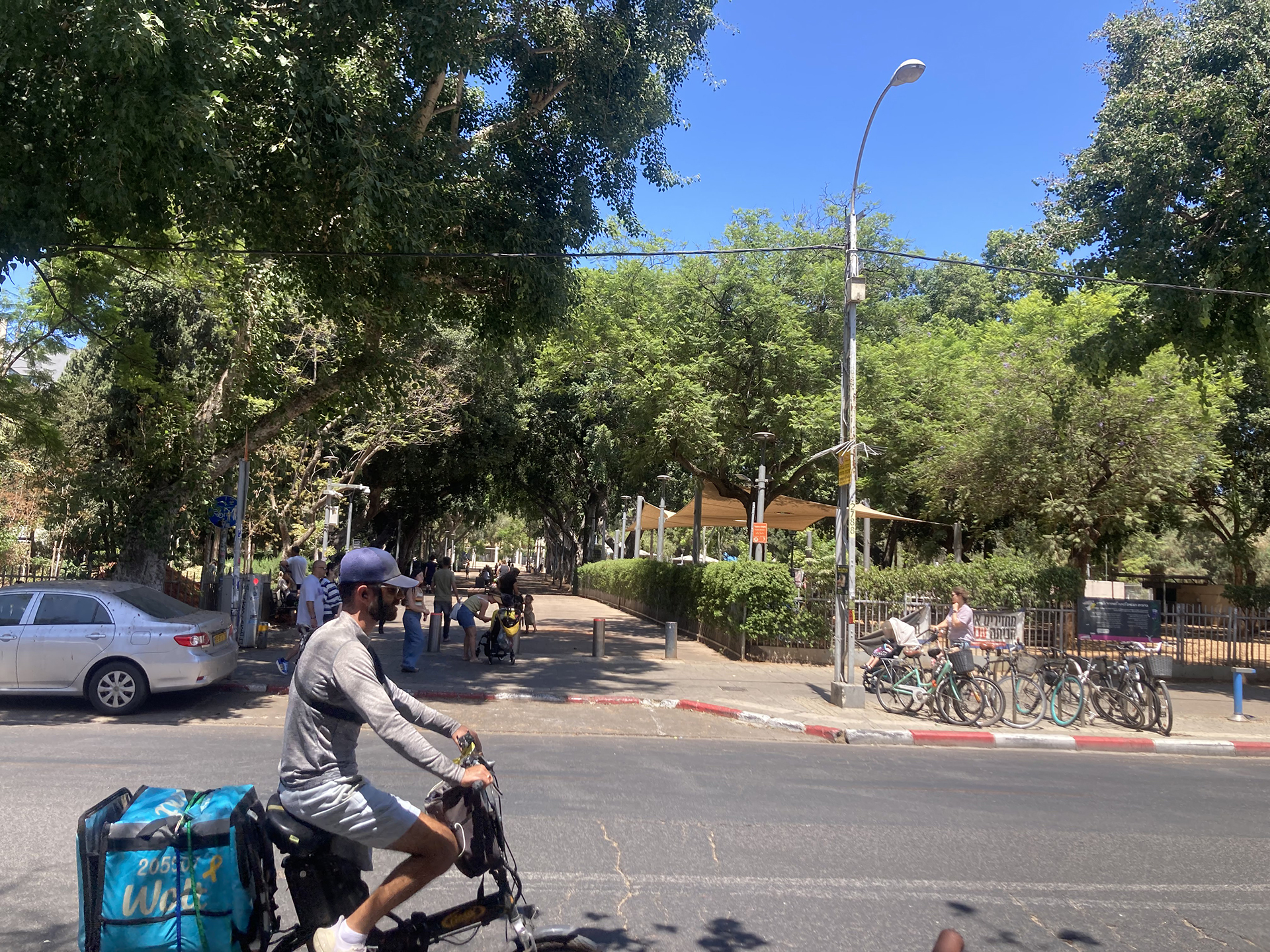
The Geddes Plan fronted the Mediterranean Sea with a “seashore drive” and “cliff path” along the upper edge of the sand and calcareous hills, with bathing beaches below. These were accompanied by open nature reserves, wildflower parks, waterfront parks, recreational spaces, a sanatorium quarter devoted to health, and sports club facilities.
All of these were linked by a pedestrian promenade stretching along the beach to the northern edge of the plan. The promenade connected the Tel Aviv Port, fairgrounds, large playing fields, and an athletics arena at the edge of the Yarkon River, envisioning the coastal strip as a landscape of sand, nature, and well-being.
During the city’s first half-century, construction of the Gordon waterfront pool (1956), the Hilton Hotel (1965), the Dolphinarium, Kikar Atarim, and the Marina in the late 1970s marked the beginning of the waterfront’s commercialization for tourism.
This process continued into the second half-century, with extensions, renovations, and the continuity of the promenade both southward and northward, alongside an increasingly urbanized waterfront dominated by hotels and luxury towers.
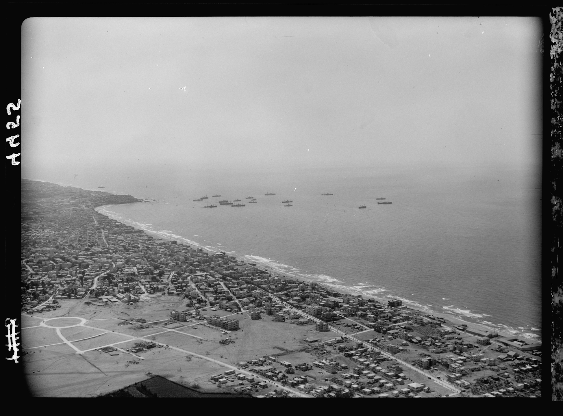
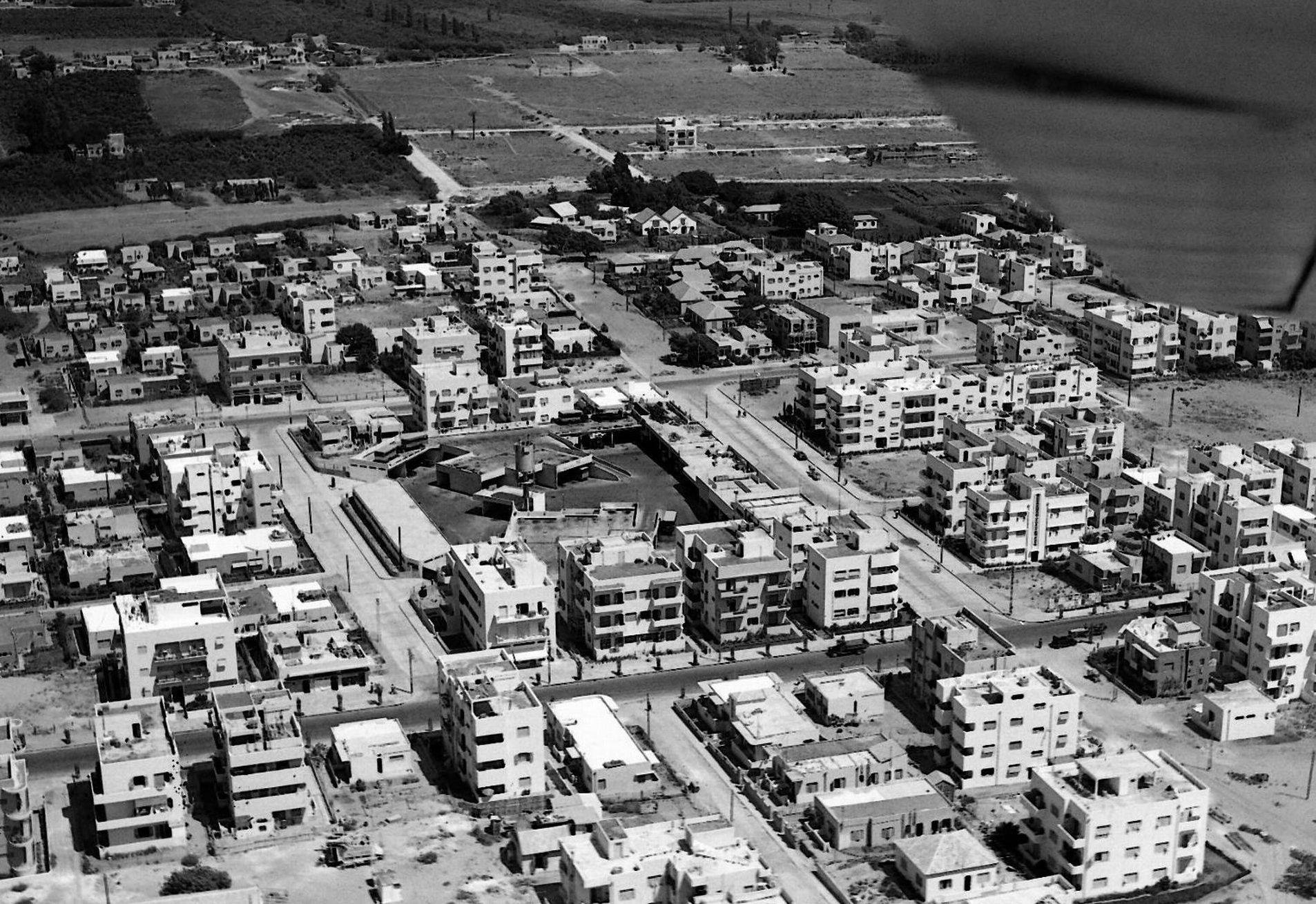
Approved in 1925, when Tel Aviv had 34,000 residents, the Geddes Plan was rapidly realized: streets and superblocks were laid out before construction, trees planted, and by 1936 its territorial extent was filled with about 130,000 residents.
By 1941, with some 174,000 inhabitants, the plan was saturated, as seen in the second German aerial reconnaissance, and by 1948, growth had spilled beyond its boundaries to roughly 230,000, all before statehood, as the participatory ethos and civic green reached their crescendo.
Gardenicity Curation, Design, Writing, Media:
Megama/Rebecca Sternberg, Keren Avni
Photo Credits:
1,8-13,15-26 – Rebecca Sternberg, Keren Avni
2-6 – Matson Collection
7 – Geddes Plan Cover, National Library of Israel
14 – Tomer Appelbaum
What Did Geddes See?
Civic Green
Growth
Sustenance
Leafy SDGs
HE/עב
Supported by The Pershing Square Foundation