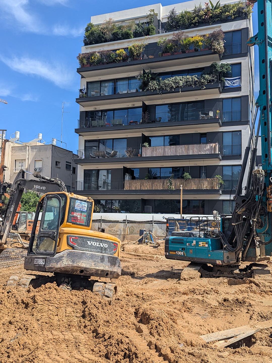
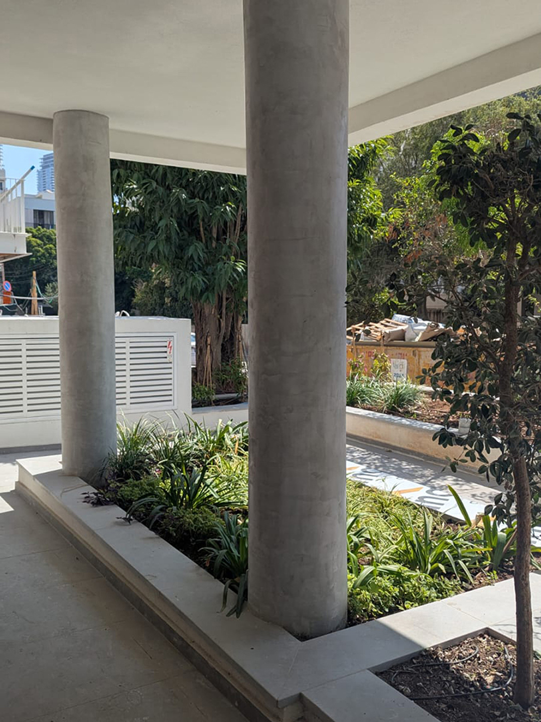
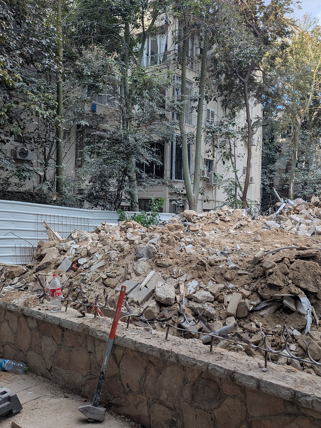
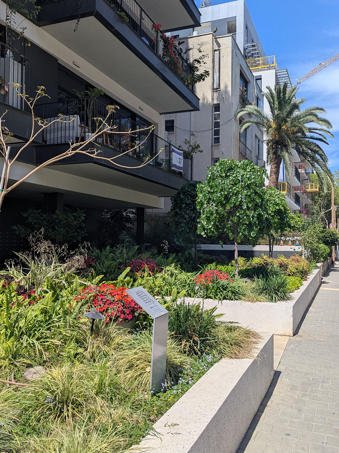
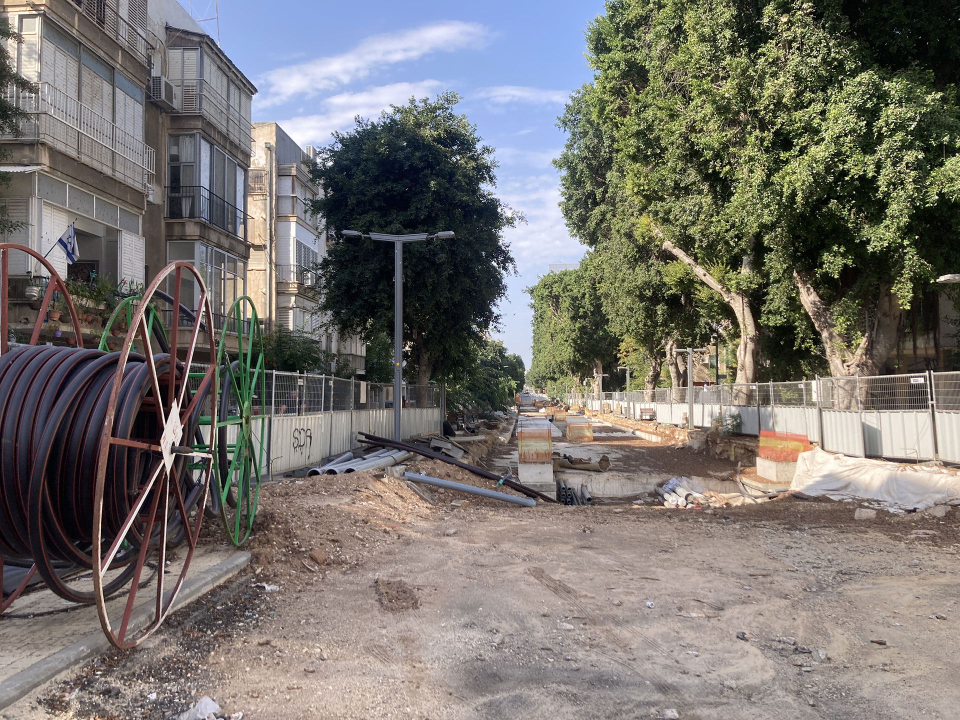
Ya'akov Mozer Street, TAMA38/2, Lot Demolition-Reconstruction, 2025
TAMA GREEN: In the first quarter of the 21st century, Tel Aviv–Yafo experienced rapid growth. The city’s population increased from approximately 350,000 residents in 2000 to about 495,000 in 2025, while the metropolitan area expanded from 2.74 million to 4.5 million. Daily commutes into the city doubled during this period, from roughly 250,000 to 500,000.
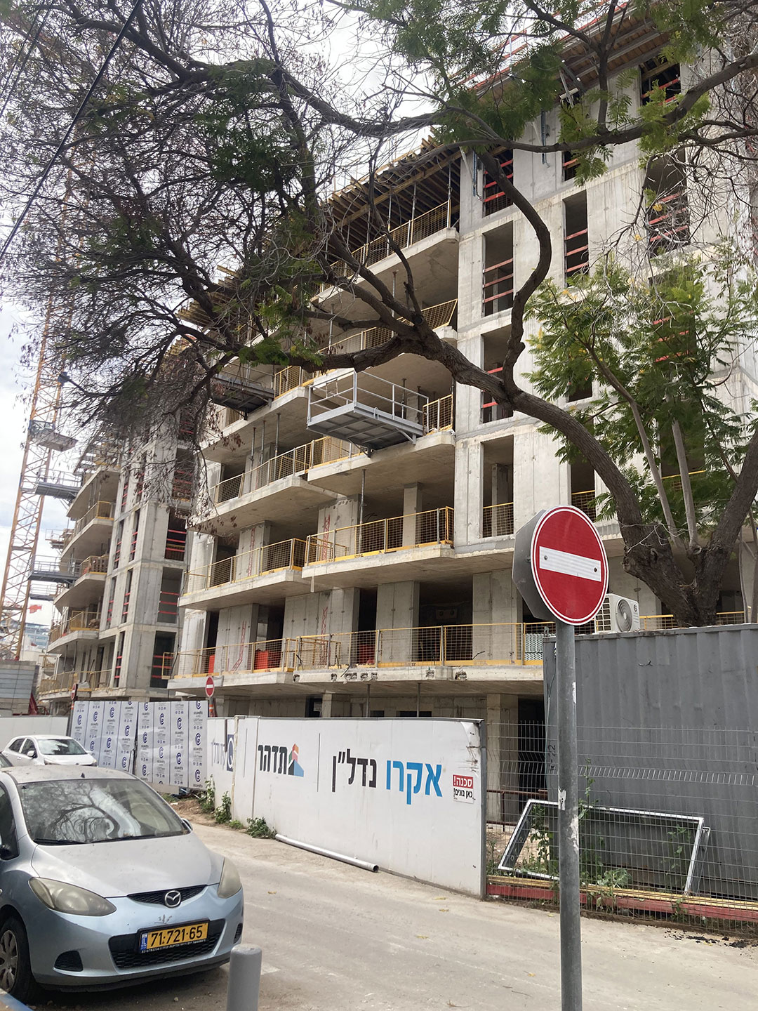
Until around 2010, much of the Geddes urban fabric nevertheless remained largely intact. This changed with the implementation of TAMA 38/2 (following Amendment 2) in 2010–2011, which for the first time enabled demolition and reconstruction as a central mechanism for urban renewal.
In Tel Aviv–Yafo—particularly in Districts 3 and 4, which encompass most of the Geddes Plan, as well as other high-demand areas in the city’s center and north (Districts 1, 2, and 5)—this shift coincided with high land values, sustained housing demand, and extensive stocks of two- to four-storey buildings on small to medium-sized parcels.
These buildings, constructed prior to modern seismic standards, typically lacked elevators, residential 'safe' rooms, and underground parking. Under TAMA 38/2, demolition-and-rebuild projects made it economically viable for developers and property owners to add floors and housing units without resorting to high-rise construction, as occurred in other parts of the city.
From 2012 onward, new municipal District Plans established clearer limits on building height, density, and built form across Tel Aviv–Yafo. Plan TA/5000 projected future urban growth through a range of building typologies (4, 8, 15, and 40+ storeys), serving as a tool to manage urban capacity, infrastructure needs, and development rights, while distinguishing areas of controlled density from zones of intensification.
Together, these planning frameworks laid the groundwork for extensive, developer-driven demolition and reconstruction within the Geddes urban fabric.
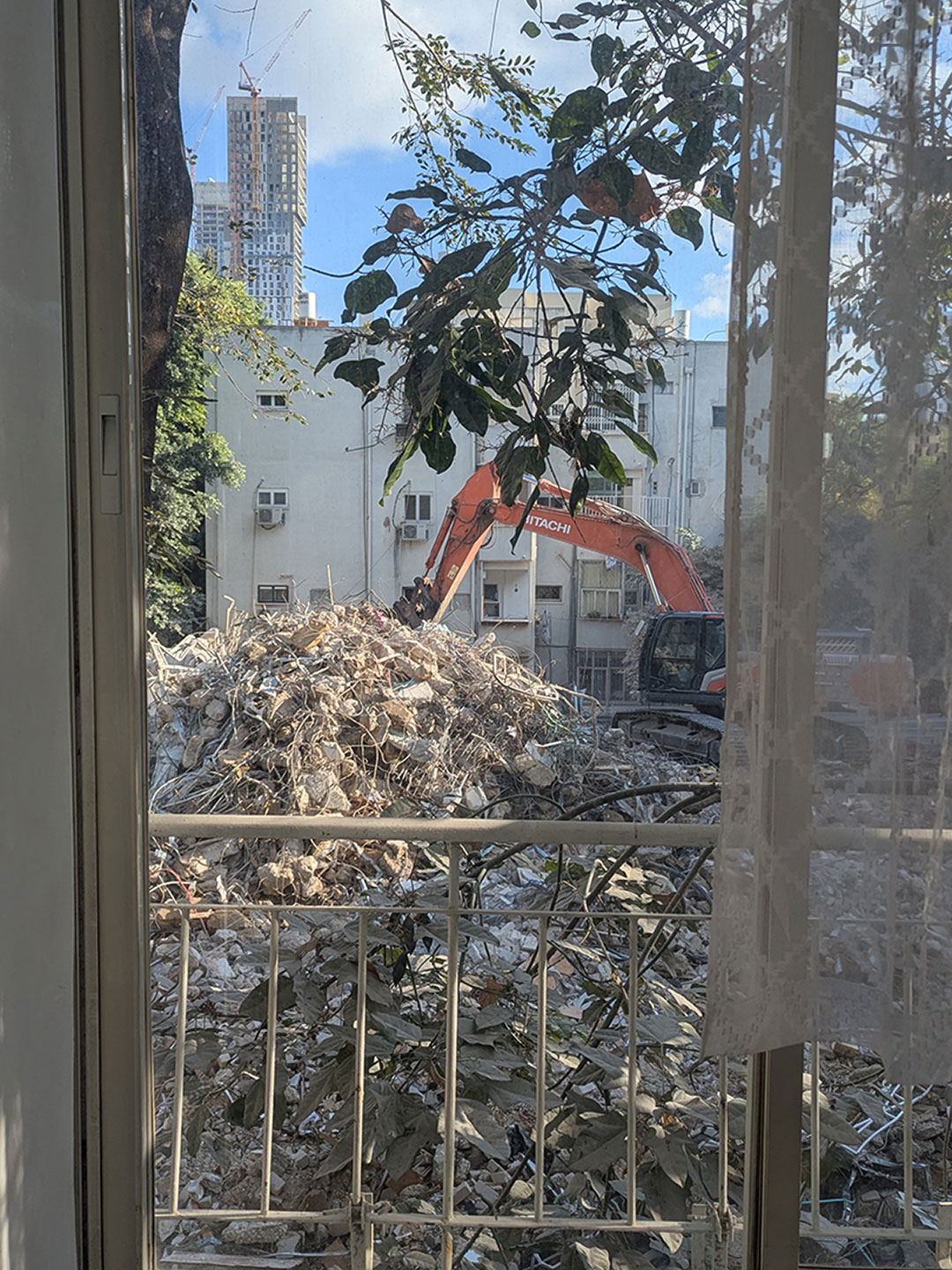
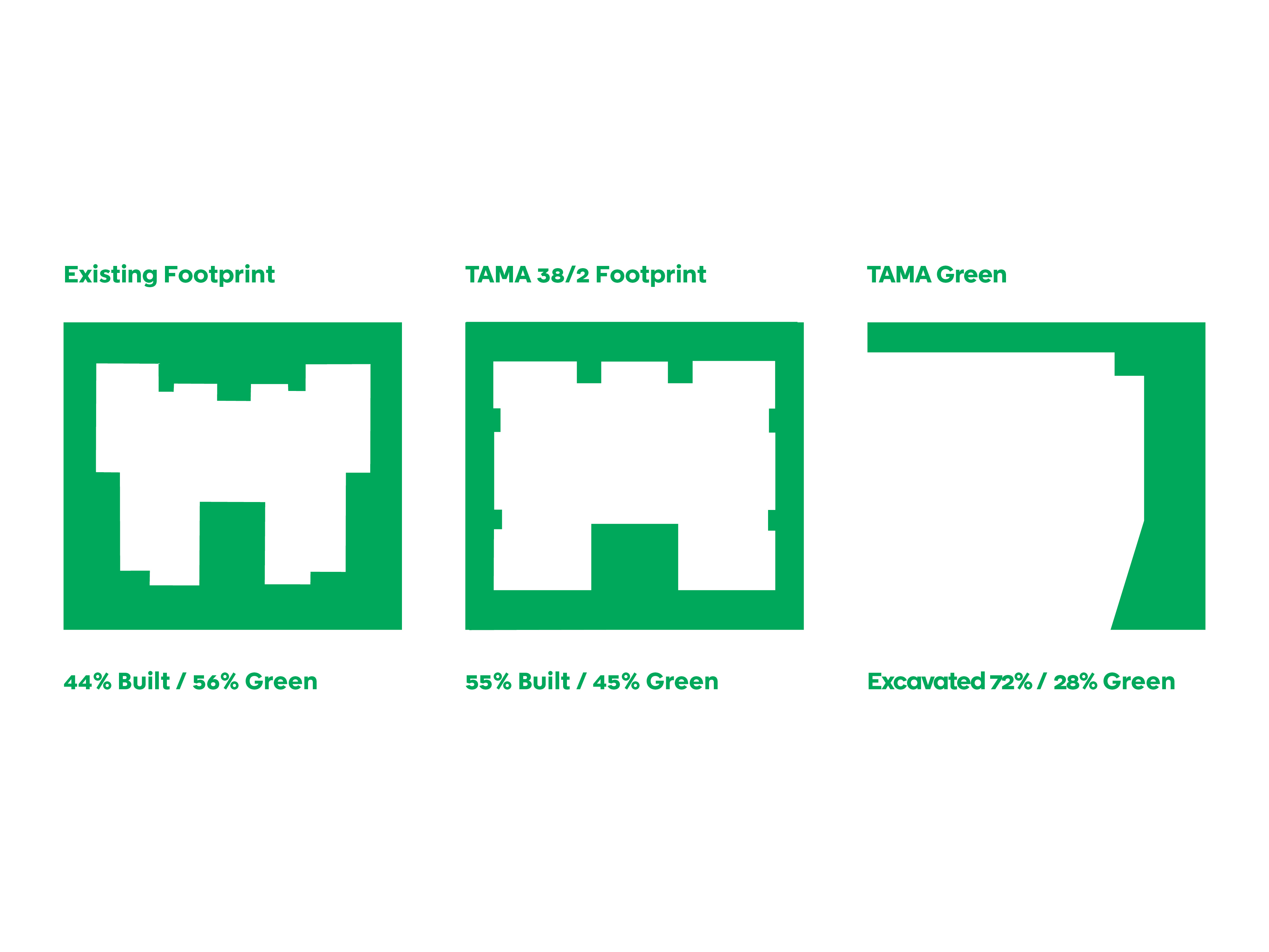
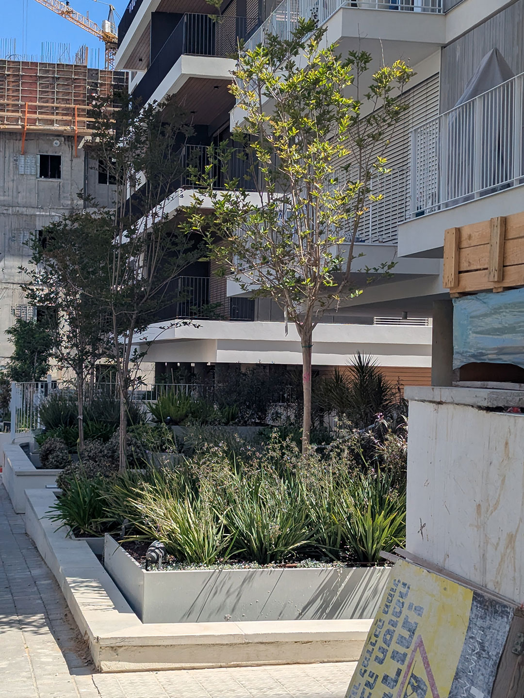
TAMA PLOT: TAMA 38/2 has reshaped the city not only upward but also downward, through the excavation of underground parking. These subterranean levels often extend several storeys deep, forming a continuous concrete slab that frequently fills most or all of the lot’s footprint.
Only a small infiltration area—typically 15–20 percent of the lot—remains as natural soil. This limited zone of deep soil is the only area capable of sustaining the roots of large canopy trees; above the concrete slabs, meaningful planting is largely impossible.
As a result, the conditions required to nurture trees have steadily diminished. Whereas roughly 60 percent of plots within the Geddes fabric once consisted of open, natural, deep soil, under TAMA 38/2 demolition and reconstruction only a fraction remains. This soil is usually confined to the sides or rear of the lot and set back from the street frontage.
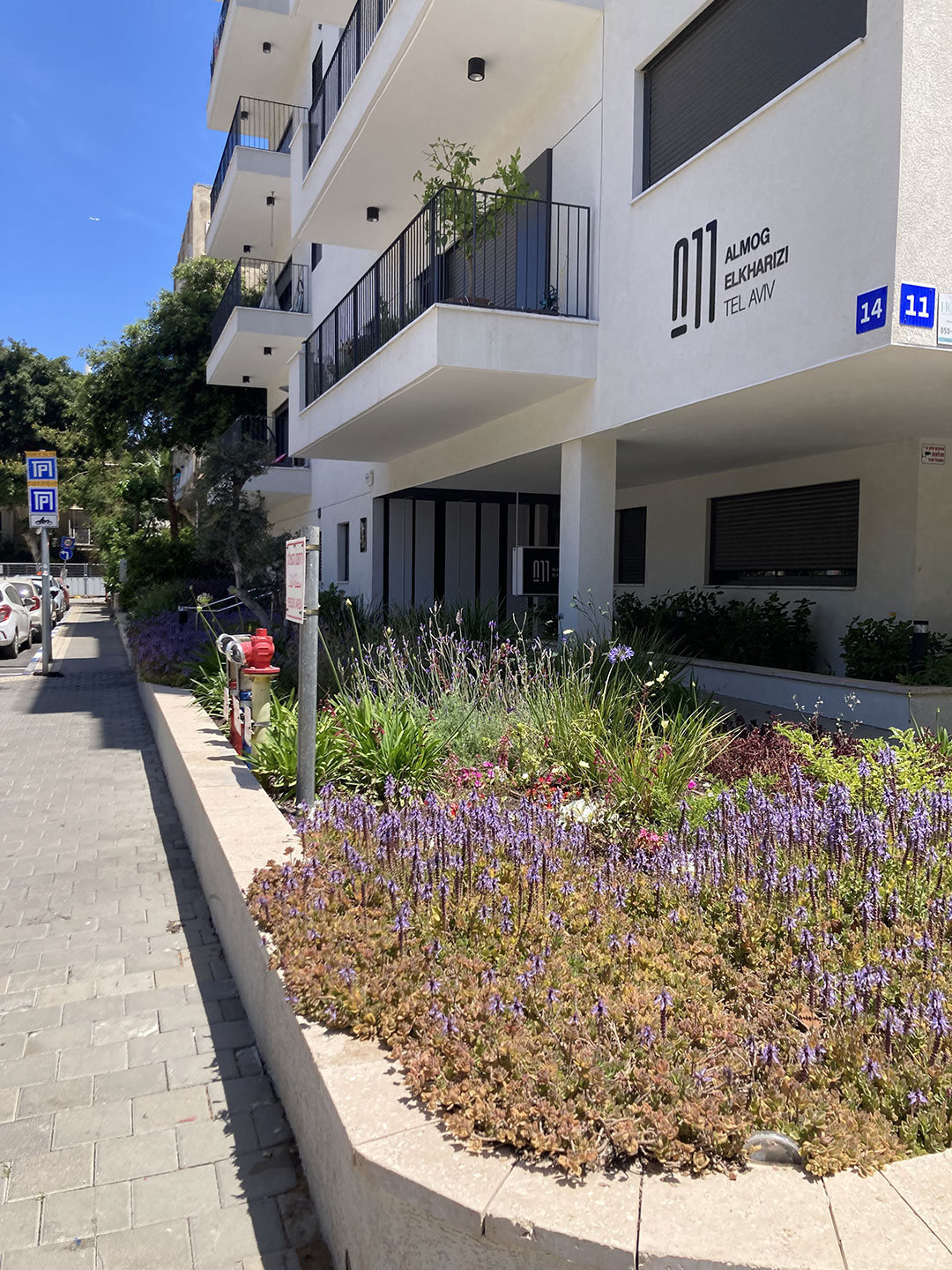
What meets the sidewalk instead are raised concrete planters, producing what might be described as “bonsai frontages”: controlled, decorative greenery devoid of large trees capable of supporting walkability, well-being, or even fruit-bearing within the city.
The removal of a mature tree in TAMA 38/2 projects requires approval under the Forest Ordinance. Applications are submitted by the developer or permit holder to the authorized Forest Officer and include detailed tree inventories specifying location, species, trunk diameter, health, and ecological value, alongside a planning justification for removal—most commonly related to underground excavation, structural foundations, or new building lines.
Formally, the review process establishes a clear hierarchy: preservation in place, relocation within the lot boundaries, and removal only where no feasible alternative exists.
In practice, however, full-site underground excavation in TAMA 38/2 projects effectively precludes both preservation and relocation. Excavation depth, basement coverage, and the absence of continuous soil volume render the preservation–relocation–replanting hierarchy largely theoretical.
As a result, most applications lead to tree removal as part of demolition. A tree compensation fee—often set at approximately 700 NIS per tree—is levied and transferred to the municipality or a designated fund.
While this mechanism enables project advancement and formal regulatory compliance, it effectively converts a local ecological asset into a limited monetary payment.
Replacement planting, when undertaken, is not required to occur near the original site and is often implemented in distant locations and neighborhoods. Although compensation may accrue at the citywide level, the local benefits once provided by the removed tree—shade, microclimatic regulation, spatial continuity, and street-level experience—are permanently lost, gradually erasing the interstitial space and green envelope that characterize the Geddes lot.
The tree-approval mechanism under TAMA 38/2 exposes a structural gap between policy intent and implementation: a declared prioritization of preservation alongside systematic removal in practice, and a reliance on financial compensation that fails to restore trees and foliage at the scale at which they were lost. Street trees located within development fire safety zones or near transformer rooms are typically removed, further reducing sidewalk greenery.
TAMA 38/2 thus systematically erodes Tel Aviv’s civic green—tree by tree, lot by lot—as buildings expand, underground parking reduces soil depth, and shaded street gardens give way to ornamental shrubs and polished entrances. TAMA gardens replace the living canopy, and with it, the life among the leaves.
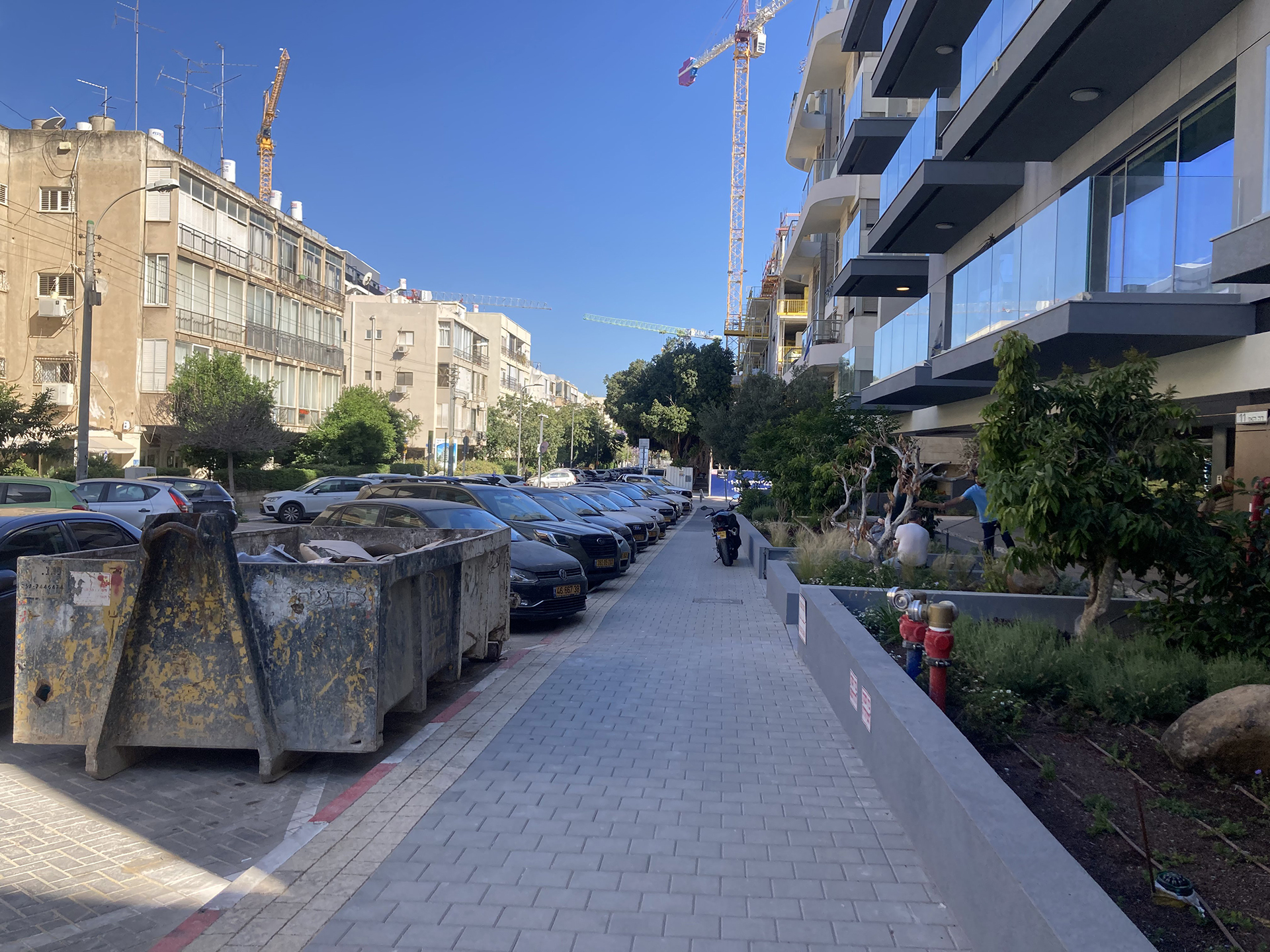
Alexander Yanai Street, Lot Clearing, TAMA38/2, 2025
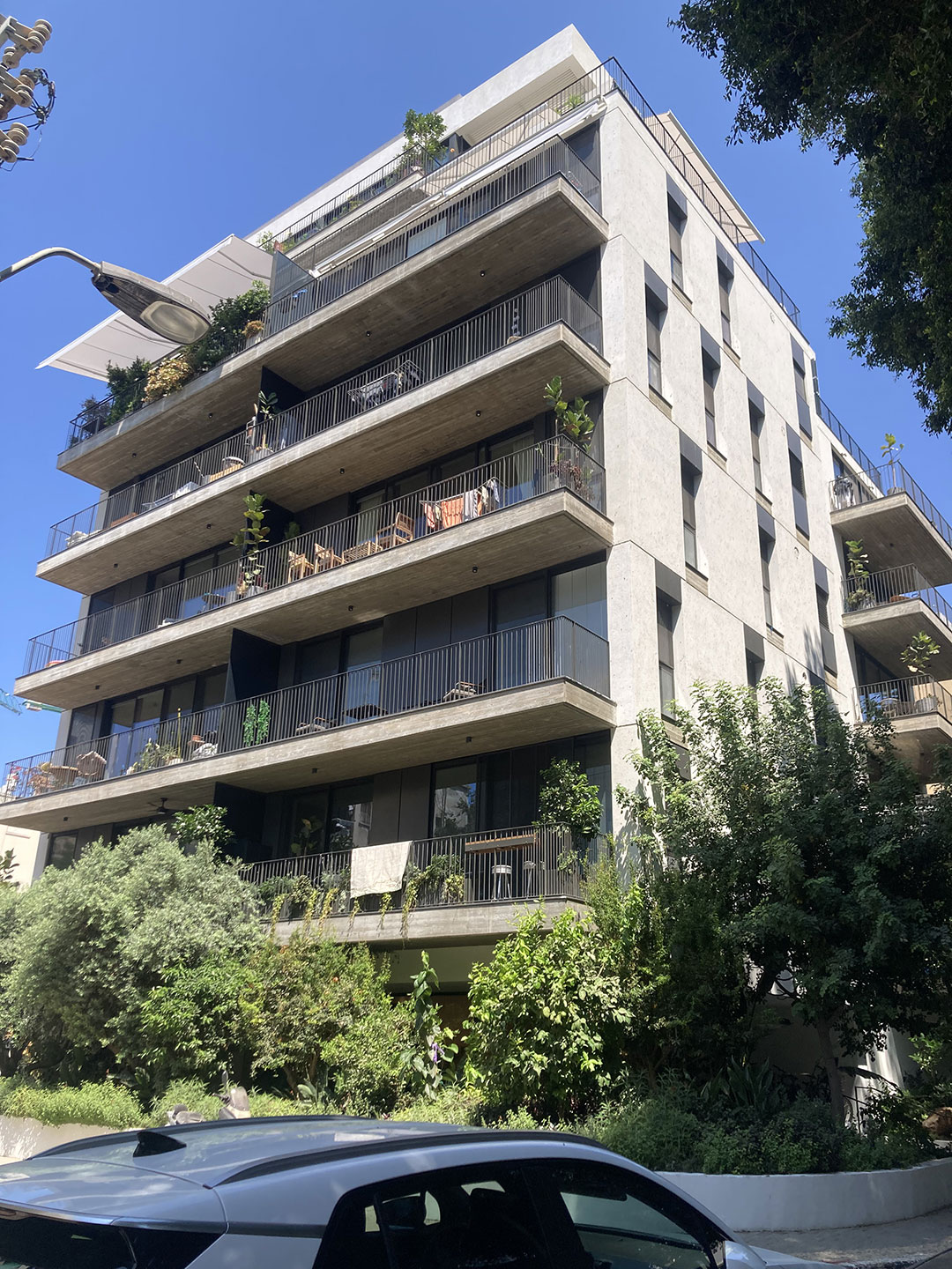
TAMA Apartments: The residential typologies that emerged under the influence of the Geddes Plan consisted primarily of three- to five-story apartment buildings, typically with three or four units per floor. Each unit was positioned at a corner of the building around a central stairwell—a configuration that ensured optimal penetration of natural light and cross-ventilation for every home.
These buildings were constructed as standalone structures on individual lots, as paired buildings sharing a common wall across two adjacent lots, or as “Workers’ Housing” (Meonot Ovdim) on consolidated block parcels at the heart of the superblock.
The apartments were not self-contained; rather, they were embedded within an enveloping greenery experienced from every window.
Jacarandas, lemon trees, royal poincianas, and more were visible from both the front and rear, accompanied by birdsong and the leafy vitality of the block and the street.
In this way, the living experience expanded beyond the confines of the apartment into a soft, green “interstitial space” that maintained a daily connection with nature.
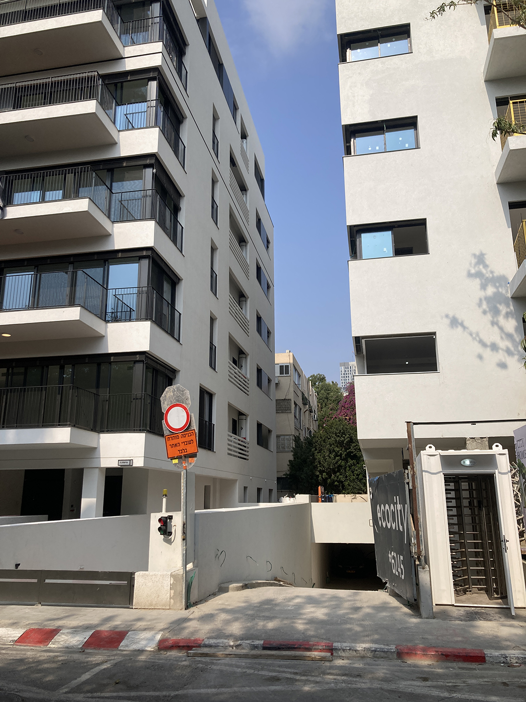
Under TAMA 38/2 (demolition and reconstruction) initiatives within the Geddes fabric, this relationship between the building and the green space on the lot is being inverted.
While each apartment gains up to 16 square meters and the building footprint increases by approximately 20 percent, the open area designated for planting is effectively halved—dropping from roughly 60 percent of the lot area to only 30 percent.
Home life is becoming more inward-looking, and windows no longer meet the tree canopy.
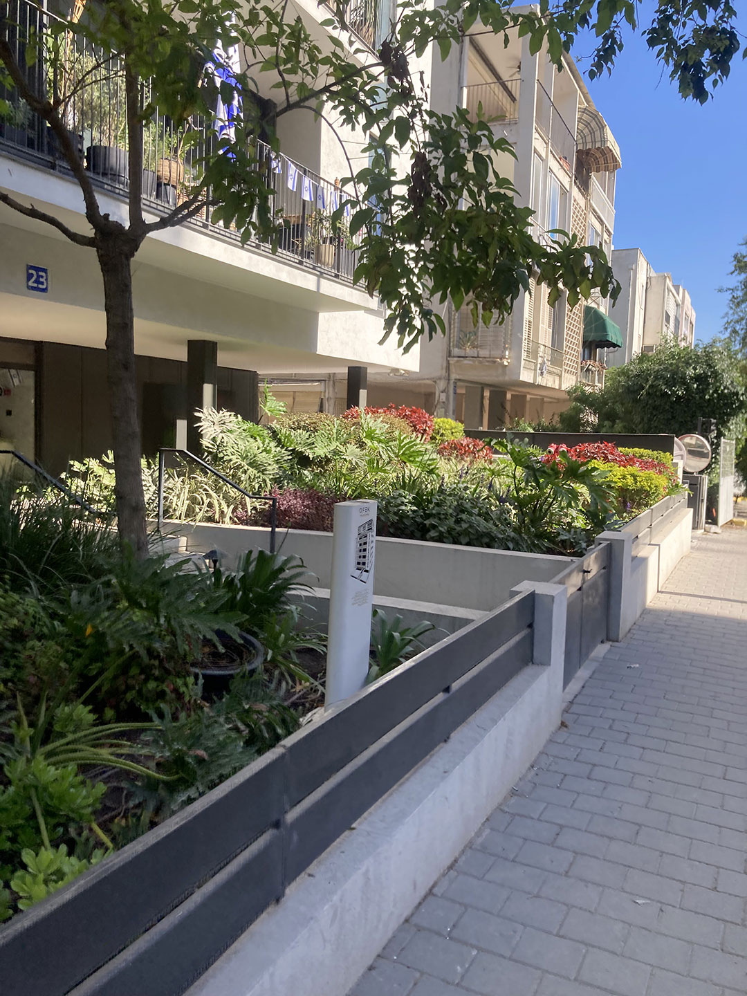
Simultaneously, the spaces between buildings are being transformed. Gaps that once functioned as shared interstitial setbacks are becoming technical zones: underground parking ramps, service passages, fences, retaining walls, and raised planters.
A bare, exposed urban experience is emerging, adversely affecting local temperatures, acoustics, and the sense of privacy.
This transformation extends beyond individual lot boundaries. As the Civic Green retreats from the streetfront, replaced by shrubs and small trees, the entire TAMA habitat shifts.
The leafy continuity of centennial treetops that once spanned blocks and superblocks is being replaced by pruned, decorative landscaping.
The disappearance of a “room with a green view” fundamentally alters the urban living experience. Moving away from Geddes’ maxim, “by leaves we live,” the TAMA era transforms leafy streets into clusters of manicured entrances, sparse in shade and in the life once found among the leaves.
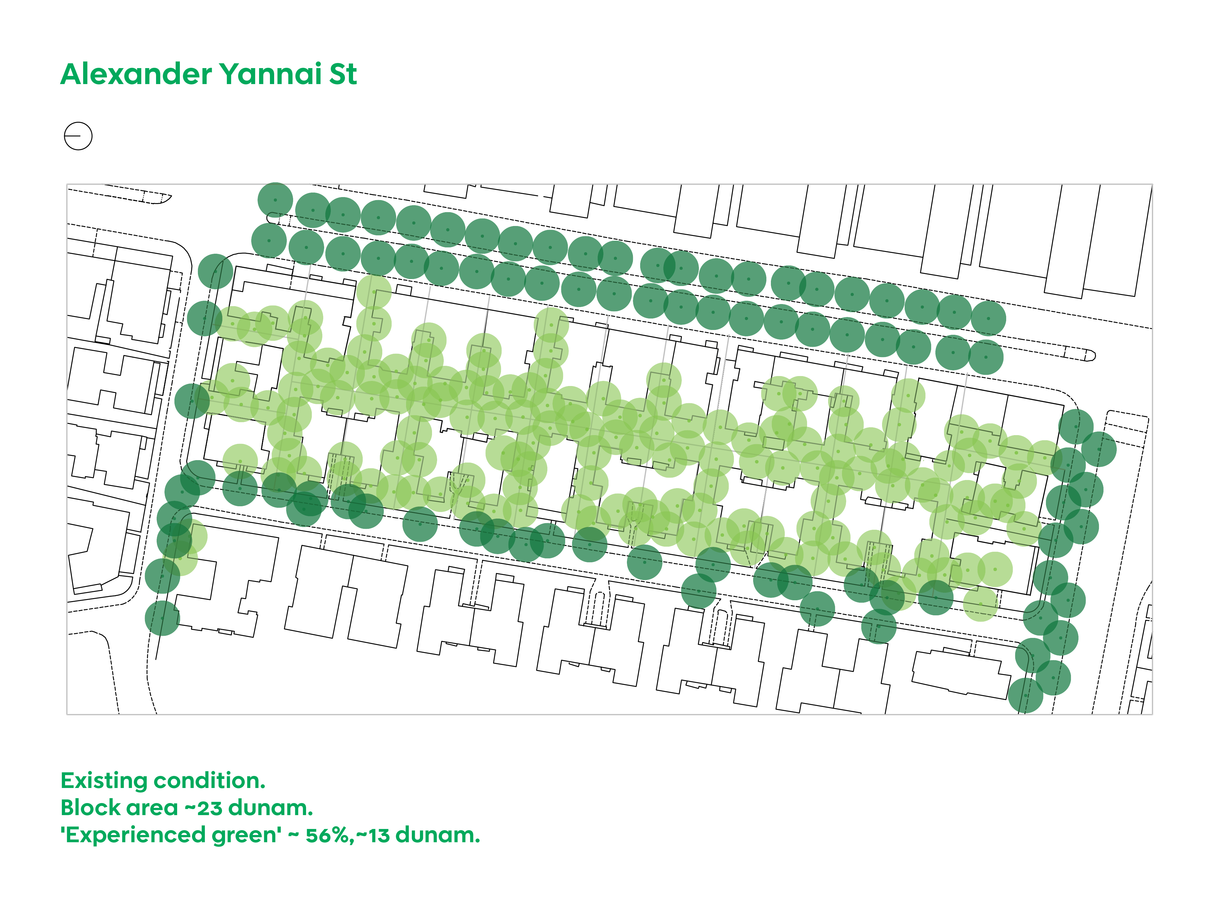
Legend
┃ Parcels / Plots
■ Approved Building Permits & Applications (2025)
● Existing Trees
● Trees at Risk
TREES AT RISK map identifies trees potentially impacted by active building permits and construction projects in 2025. Within each lot, trees directly threatened with removal by the approved development are highlighted in red.
The map illustrates the cumulative impact on the city’s Civic Green fabric. These consequences are typically assessed on a per-permit basis rather than as the aggregate, citywide effect of TAMA 38/2 projects.
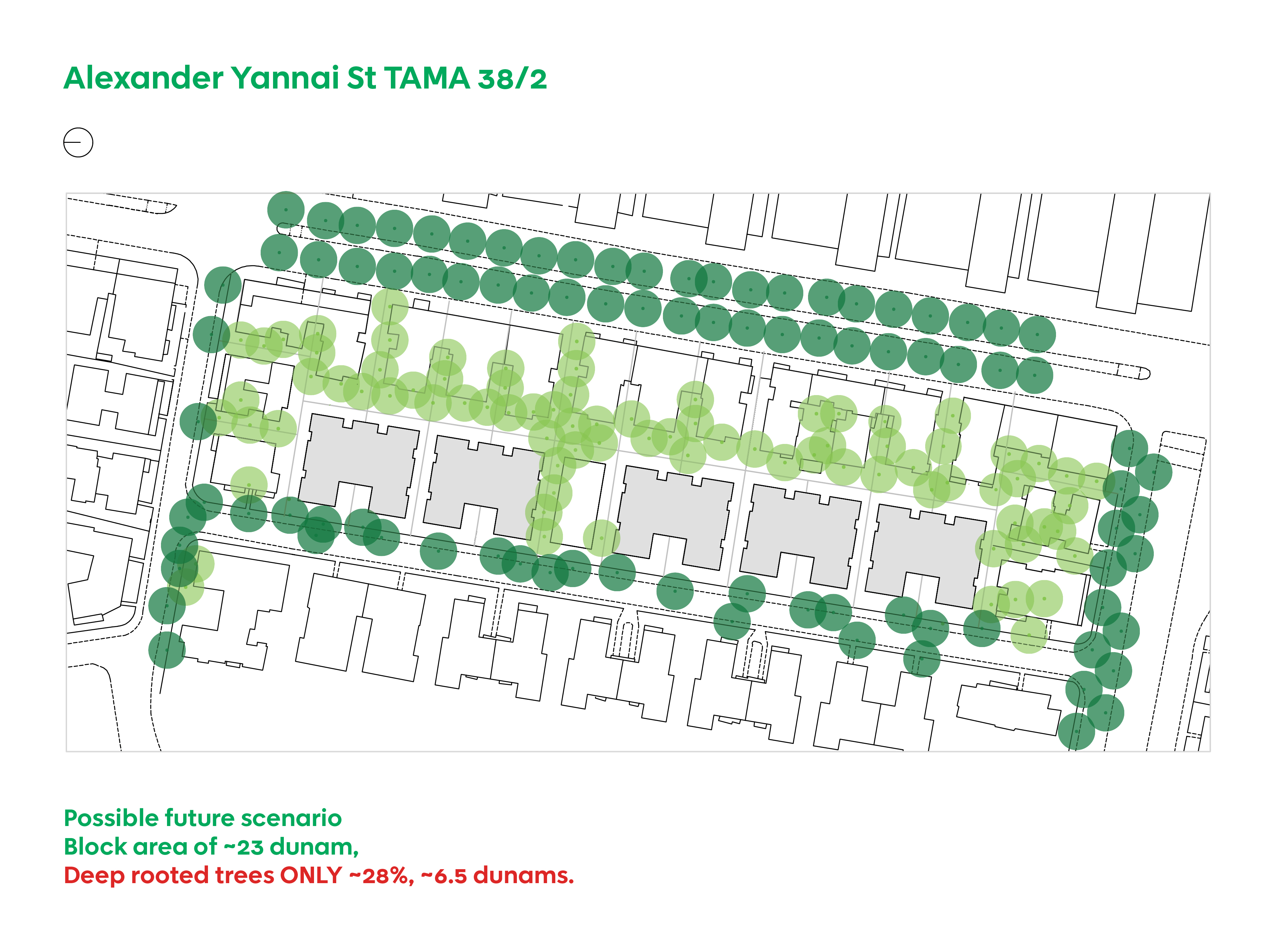
Alexander Yanai: A Green Street Story. The Rimona Private Cooperative Housing Association on Alexander Yanai Street represents a unique intersection of private ownership and communal management within the historic Geddes Plan.
Built between 1945 and 1952 in Zone C, the complex was named "Rimona" (a portmanteau of Romania) to reflect the origins of its founders: middle-class Jewish professionals who immigrated from Romania.
The buildings flank Alexander Yanai Street, an intimate residential road within a classic "super-block" bounded by Nordau Boulevard, Ibn Gabirol, Horkanus, and Yehoshua Bin Nun. By merging two plots, the four-story mirror-image buildings share a common wall—an architectural strategy that unified the street entrance while maximizing airflow and views. Most significantly, this consolidation created expansive communal gardens in both the front and rear.
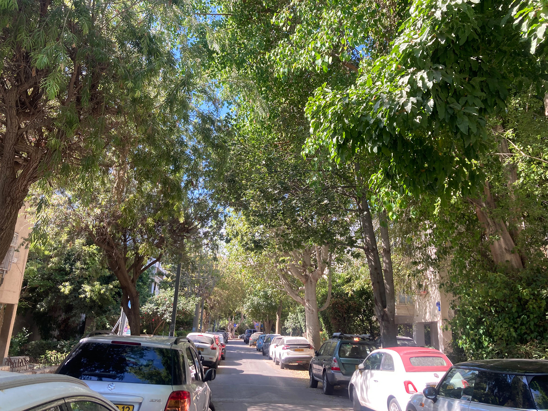
The street is defined by a dense tree canopy.
The most prominent species is the Illawarra Flame Tree (Brachychiton\ acerifolius), known for its vibrant red blossoms, alongside veteran Chinese Banyans (Ficus\ microcarpa), Mediterranean Cypress, Dragon Trees, and Frangipani.
At its peak, this 13-dunam green space hosted hundreds of mature trees, creating a continuous, lush canopy that provided shaded, leafy living within the urban block.
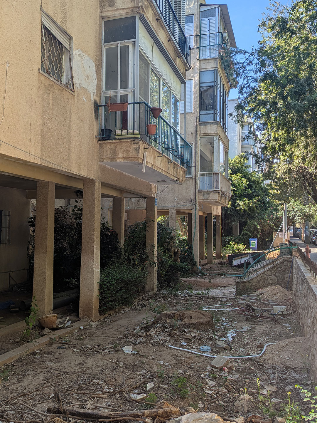
Under current TAMA 38/2 (demolition and reconstruction) plans, this historical cooperative model is being replaced by commercial development. Original blocks are being replaced by six-story buildings, increasing the footprint by 11–20%, while underground parking will occupy 72% of the consolidated plots.
This excavation causes a critical loss of deep soil, halving the site's deep-root green space from 56% to just 28%. Consequently, approximately 40 mature trees per lot are at risk under active permits.
Expert assessments recommend preserving only one tree within plot boundaries; the five others slated for preservation are actually located outside the plot. With no transplanting proposed, the felling of 35 (88%) of trees per lot has been approved.
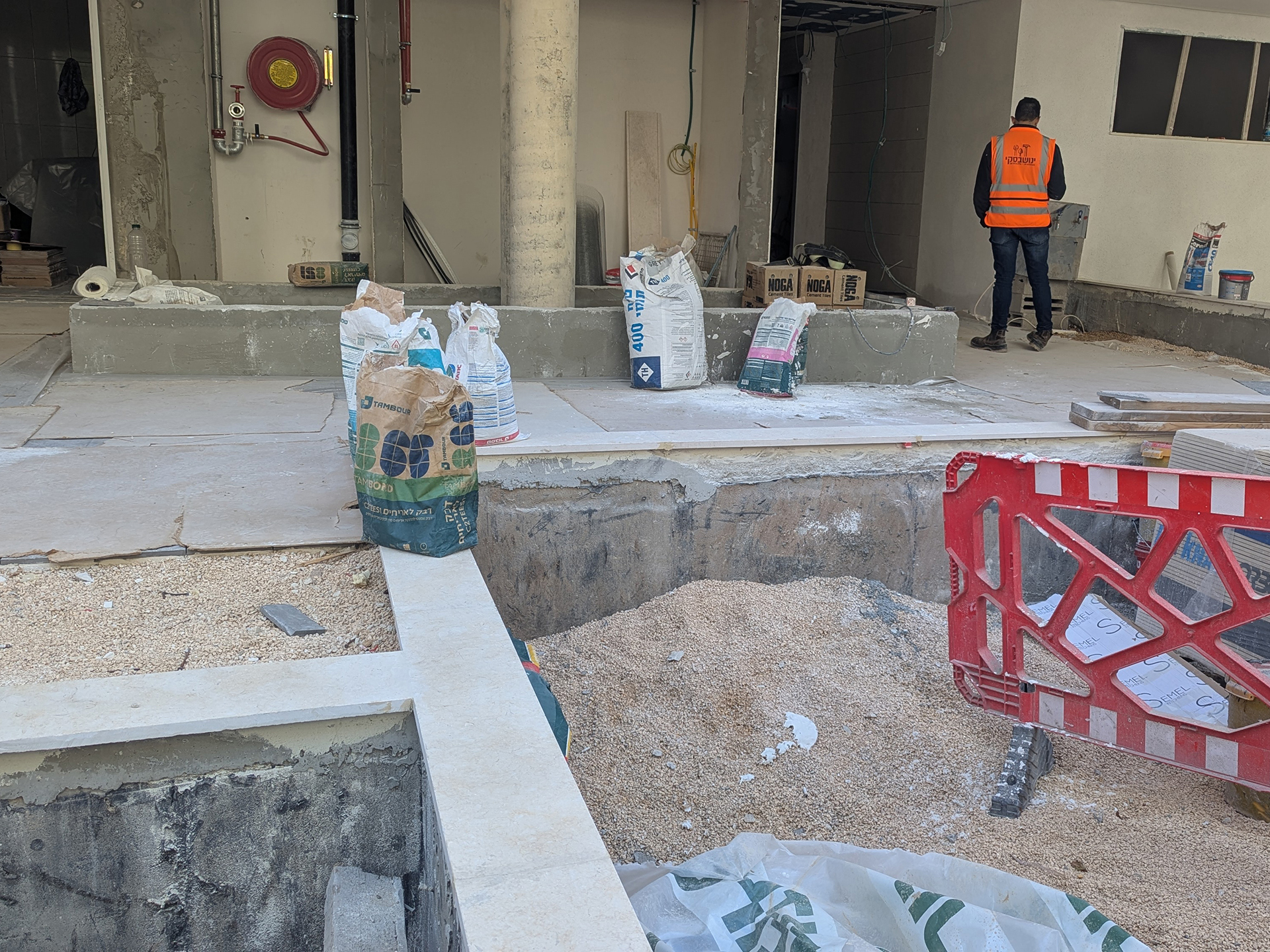
Concrete Podium Planters for On-Slab Greenary, Ben Saruq Street, 2025
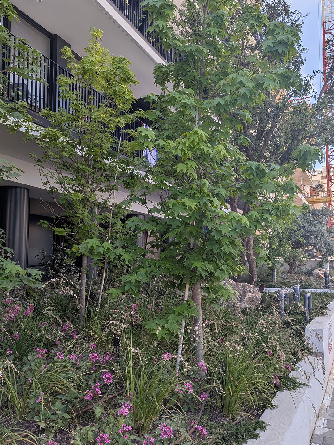
TAMA Gardens: Shaped by Geddes’ Civic Green vision, approximately 40% of Tel Aviv-Yafo’s trees—around 110,000—grow on private lots. These sites host a mix of deep-rooted trees that stabilize sandy soils and lateral-rooted canopy giants that provide extensive shade. Together, their canopies extend over yards and sidewalks to form a continuous habitat that moderates temperature, supports biodiversity, and enhances urban well-being.
When a Geddes lot undergoes TAMA 38/2 redevelopment, the entire site is excavated. This process removes the primary sources of functional shade: Ficus and Morus (present in 35% of lots), fruit trees like Citrus and Punica (25%), shade giants such as Poinciana and Jacaranda (10%), and vertical anchors like Cypress and Araucaria (10%). While palms and shrubs are more numerous, they offer negligible canopy value.
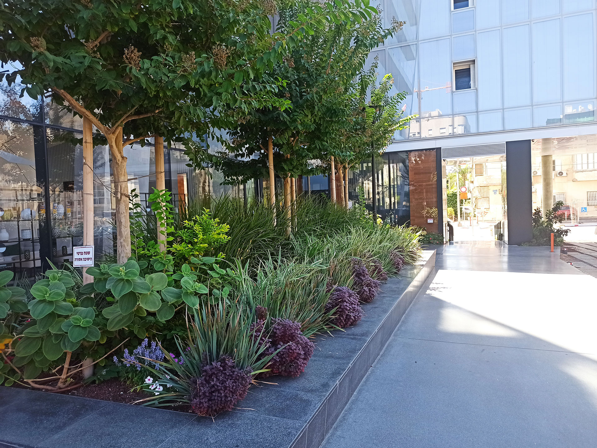
The transformation of a typical 500-square-meter lot is stark. Before redevelopment, four to five mature canopy trees provide roughly 80% shade over unbuilt ground. Afterward, TAMA "podium gardens" typically contain four to five small trees in containers above the parking slab, delivering no more than 20% shade.
This uprooting disrupts ecological corridors for birds and pollinators. Furthermore, the required replacement species fundamentally change; trees are selected for non-invasive roots, leading to a reliance on ornamental genera like Plumeria and Bauhinia, which provide 70% less shade. Planted in shallow tubs, their roots are confined and canopies stunted—creating permanent "bonsai" versions of once climate-active trees. To simplify maintenance, natural soil and building setbacks are often replaced with hardscaping.
The net result per TAMA 38/2 lot is a 65% canopy loss, a sharp decline in biodiversity, and diminished deep-soil hydrological function. The replacement gardens offer only ornamental green, largely disconnected from the ecological processes once sustained by the city's shared civic green.
Centennial Stress Test: In March 2020, the COVID-19 pandemic transformed daily life in Tel Aviv-Yafo, mirroring global patterns. As movement was strictly limited—initially to 100 meters, then expanding to one kilometer—the city’s behavior shifted entirely toward home-based, neighborhood living.
Nearly a century after its inception, Patrick Geddes’ green vision experienced a modern "swan song." Residents repurposed shared front and back yards, along with rooftops, as communal outdoor recreation spaces. Neighborhood markets emerged in the internal gardens of Geddes super-blocks, while boulevard benches served as makeshift workstations or outdoor breakrooms.
Public spaces and local parks underwent a functional shift. Car-free streets were reclaimed by pedestrians, and restaurants expanded onto sidewalks with outdoor seating. Parks transformed into socially distanced picnic areas for food deliveries, civic plazas hosted essential infrastructure like vaccination tents, and beaches offered a quiet refuge—completing the city's temporary embrace of its original "Garden City" roots.
Post-COVID, a confluence of independent events has coalesced into a systemic stress test for Tel Aviv-Yafo at the centennial of the Garden City. The upending of office tower tax revenue models, the disruptive construction of the Green and Purple light rail lines, the redevelopment of Sdeh Dov airport into a developer-driven northern quarter, and the expiration of the TAMA 38 framework have fundamentally challenged the city's green spatial logic.
Coupled with a deepening housing affordability crisis and the acute trauma of regional war and missile attacks, these forces represent a radical departure from Geddesian precepts.
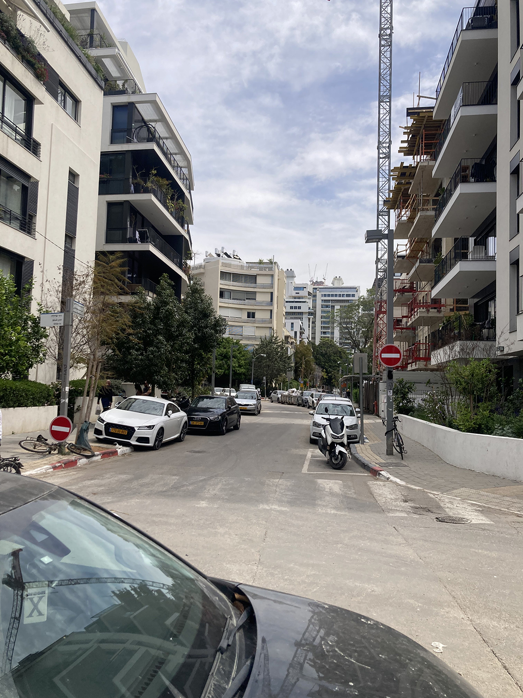
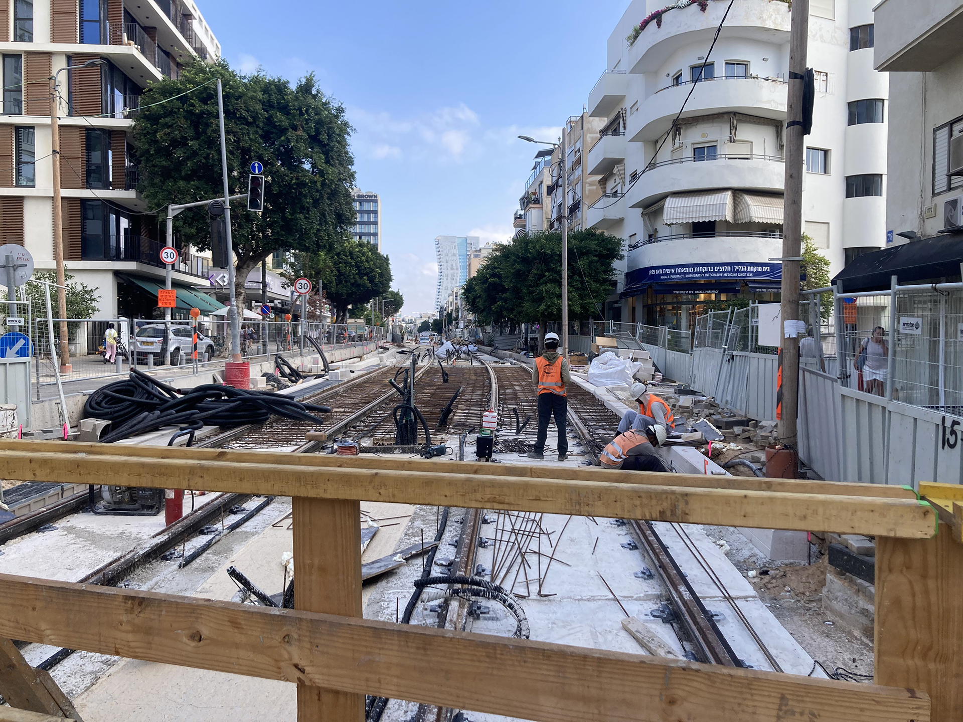
The most immediate physical disruption to the Geddesian fabric is the construction of the Light Rail (LR) network. For a projected decade, public spaces have been reconfigured into management zones and operational sites. Simultaneously, the construction of rail lines on Geddes’s main streets—Ibn Gabirol, Arlosoroff, Ben Yehuda, and Allenby—is upending the "neutral" and optimized mixed-use street grid that defined Tel Aviv’s vitality and flow.
The Green Line & Ibn Gabirol: The transformation of the Ibn Gabirol axis into a corridor of shuttered stores—an ongoing temporary dormant state intended to last ten years—threatens the survival of the street's diverse retail ecosystem and its role as the Geddesian arcaded north-south "spine."
The Purple Line & One-Way Logic: Reconfiguring Arlosoroff, Ben Yehuda, and Allenby streets into one-way vehicular traffic disrupts the bi-directional flexibility of the Geddes plan. This shifts the functional scope of these streets, prioritizing regional transit throughput over local, multi-directional neighborhood life.
The Re-sectioning of King George: Significant changes to King George Street include a dramatic narrowing of the street section and a shift to one-way, slow-moving traffic, further constricting access to shops and circulation.
While the intent is to heighten pedestrian and micro-mobility while reducing vehicular dependency, the long-term impact on the Geddes grid’s multifunctional continuous circulation remains a profound urban unknown.
Ben Yehuda, Arlosoroff Streets Purple Light Rail Construction, 2025
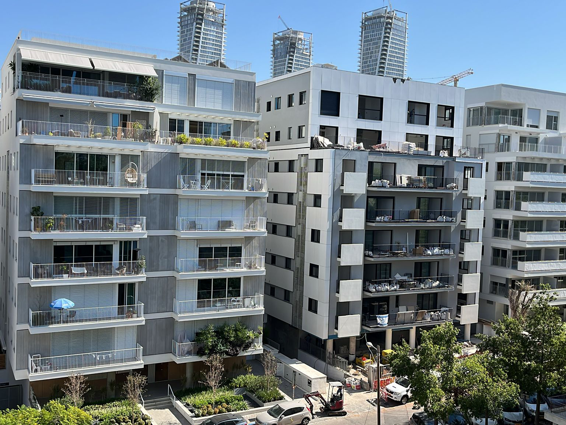
Upscaling Beyond the Green: The tower-ification of Tel Aviv, accelerating from the late 1990s to the present, represents a radical departure from the Geddes fabric and its consistent four-to-six-story scale. Within the historic center, vertical breaches occurred primarily on super-blocks occupied by single institutions or on unbuilt, disputed, and unparcelled tracts.
Rova Lev Ha'ir (2004–2005) introduced the "tower and wall" residential model, marking the first erasure of the indeterminate lot-garden-block-street fabric. By occupying an entire super-block, the project evacuated its center to create an oversized interior private open space, flanked by a six-story residential perimeter and a high-rise tower.
Simultaneously, Rothschild Boulevard transitioned into a high-rise Central Business District—a shift beginning with the Alrov Tower (1999) and culminating in the 2010s with glass icons such as the First International Bank Tower (2010) and Meier on Rothschild (2015).
This vertical aberration pushed north to the Arlozorov axis on the site of the former Dan bus terminal. There, the completion of Arlozorov 17 (2019) and Arlozorov 10 effectively doubled the site's density, utilizing an underground parking roof to support a playground that fills the remainder of the super-block.
The Assuta Tower followed this same model, joining a growing list of towering "exceptions." Today, this evolution reaches its climax at the city’s administrative core on Ibn Gabirol Street. With the construction of an island of developer-driven towers and the New Municipality/District House on the former Summayl site, the transition is finalized: the Geddes civic green has been superseded.
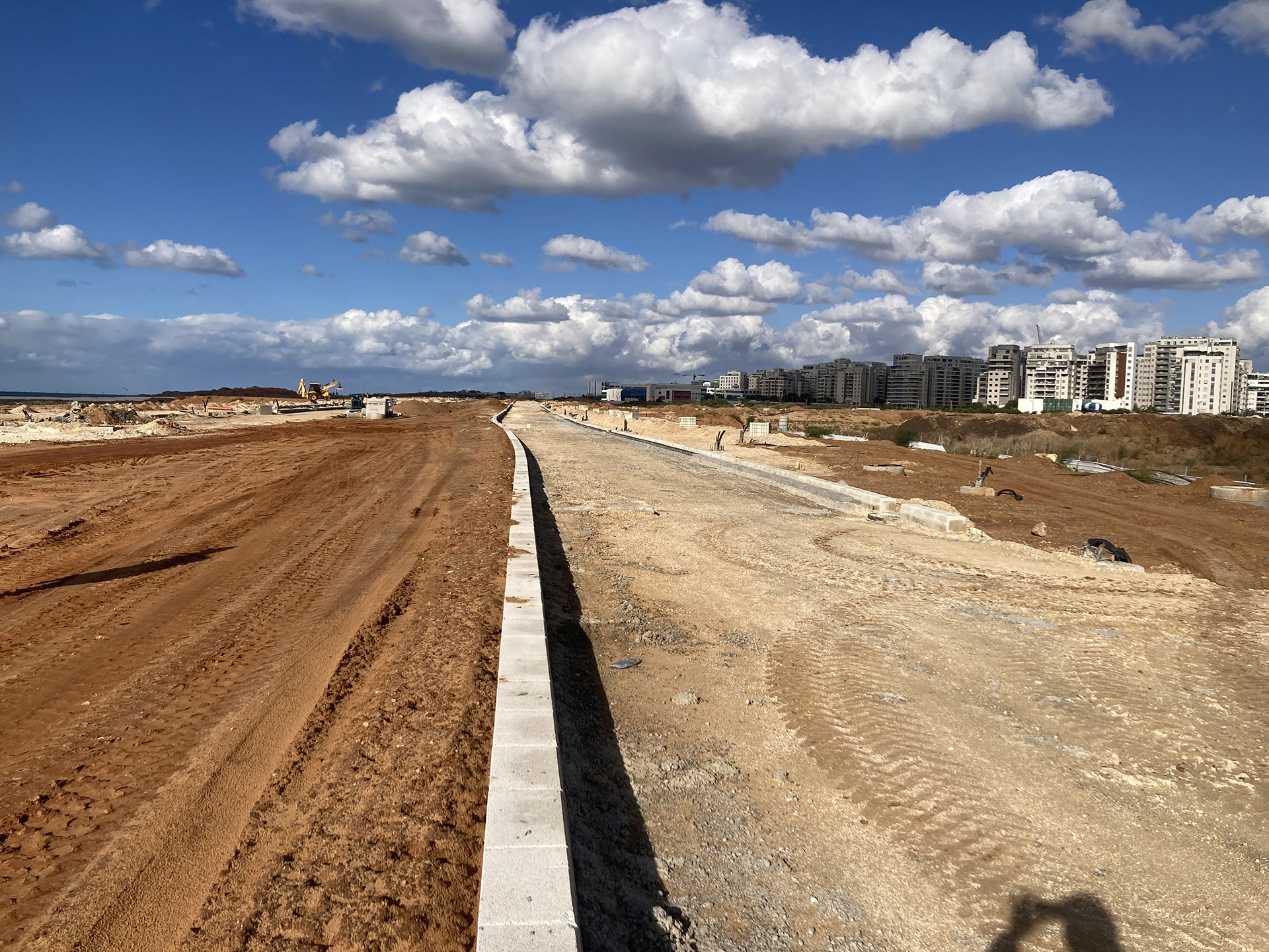
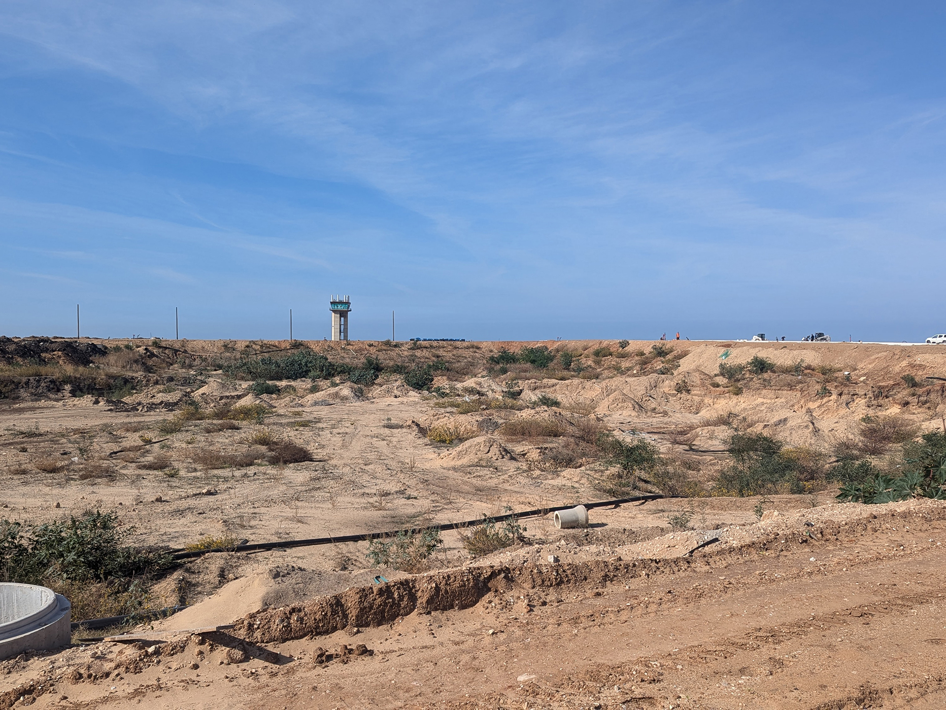
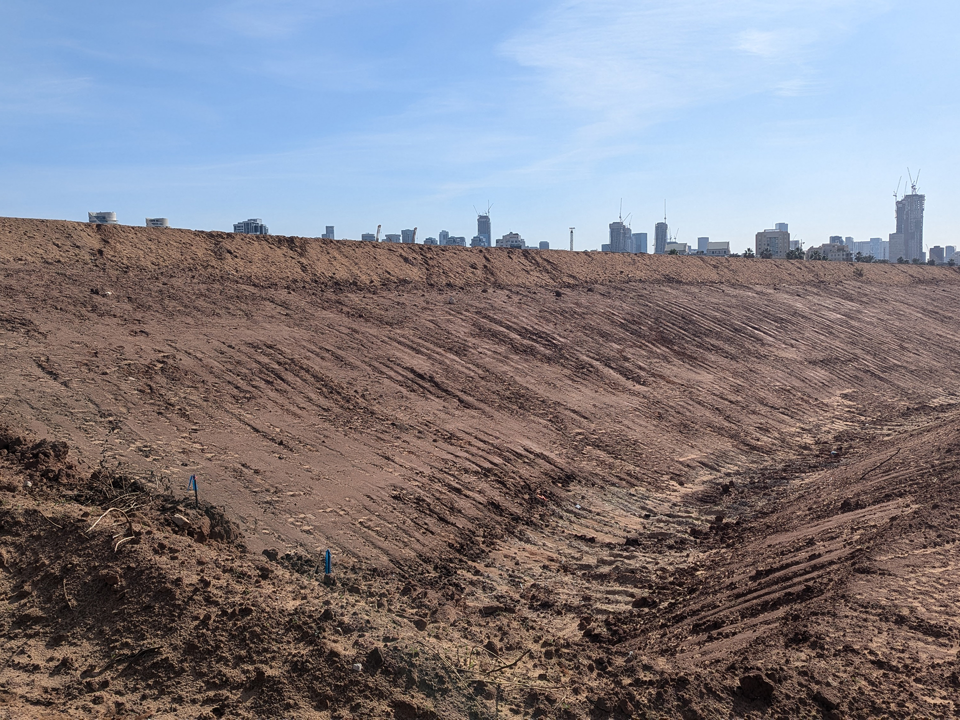
In 2019, Sdeh Dov Airport was decommissioned, making way for a northern extension that serves as the developer-driven antithesis to the foundational Garden City.
Although planned in the early 2000s as a sustainable ode to Geddes, the district instead consists of a series of single-developer super-blocks.
These massive compounds, averaging 100 by 250 meters (approximately 37,500 sqm per "mega-lot"), represent a scaled-up mutation of the tower and wall logic. In this model, a private green space is enclosed by an eight-story residential perimeter and two to four towers, achieving a high net density of approximately 54 housing units per dunam under a binary system of green (private vs. public).
Here, Ibn Gabirol Street expands into a six-lane transportation artery, serving as the central commercial axis intersected by east-west streets that link the super-blocks to a new waterfront park and the sea.
This shift toward large-scale, district-level planning was codified in 2024 when the Tel Aviv Municipality allowed the TAMA 38 framework to expire. It was replaced by the TA/5050 plan (and the broader TA/5500 strategic update), which officially moves away from individual building-level reinforcements in favor of district-wide management of "building stock" metrics—volume, height, and density—largely sidestepping the city's leafy infrastructure.
At the close of the Geddes Plan centennial, the focus of development has fundamentally shifted, absconding with Tel Aviv’s green spatial logic and its participatory, civic legacy—a verdant source of resilience that served as the city’s truest asset. In its place, Tel Aviv is adopting a developer-driven concrete district model, where its organic, indeterminate nature is effectively unseeded.
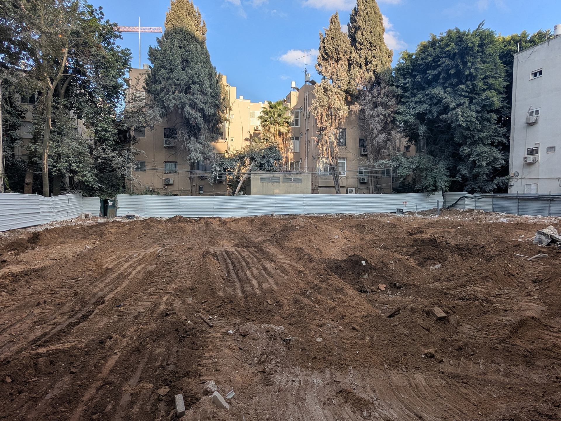
Earthworks, Berm, Sdeh Dov, 2025
Gardenicity Curation, Design, Writing, Media:
Megama/Rebecca Sternberg, Keren Avni
Photo Credits:
1, 8 – Naama Meishar
6 – Galit Shiff
2-5,7,9-20 – Rebecca Sternberg, Keren Avni
What Did Geddes See?
Civic Green
Growth
Sustenance
Leafy SDGs
HE/עב
Supported by The Pershing Square Foundation