Bavarian Air Force (Fliegerabteilung 304b), Reconnaissance Aerial Photograph, Tel Aviv, 1917.
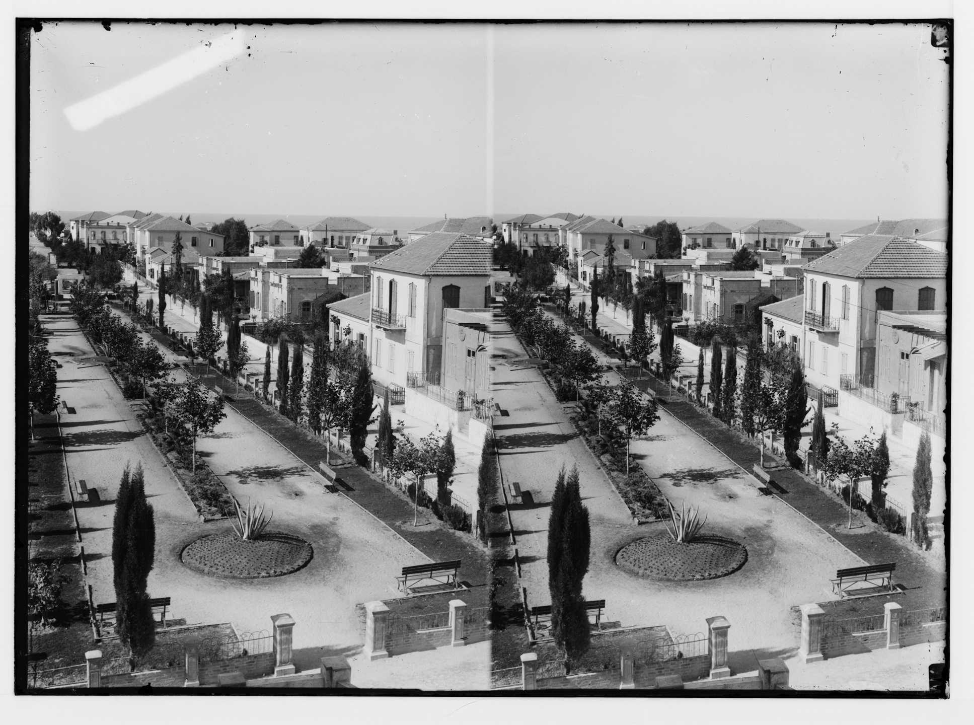
WHAT DID GEDDES SEE offers a view into the green contexts that Geddes encountered: Jaffa’s orange culture, mission-driven agriculture, and emerging infrastructure, all of which informed his vision of a Garden City planted in the sand.
In 1919 At the age of 65, in the aftermath of the influenza pandemic and the disruptions of World War I, Patrick Geddes was first invited to visit Palestine to plan the Hebrew University campus on Mount Scopus.
He returned in 1920, and again in 1925 to Tel Aviv, where he was commissioned to design the city’s first master plan.
By this time, Geddes was internationally recognised for his environmental and civic planning, having introduced the prescient 'survey before plan' methodology, which begins with a study of social, economic, and physical conditions before shaping proposals.
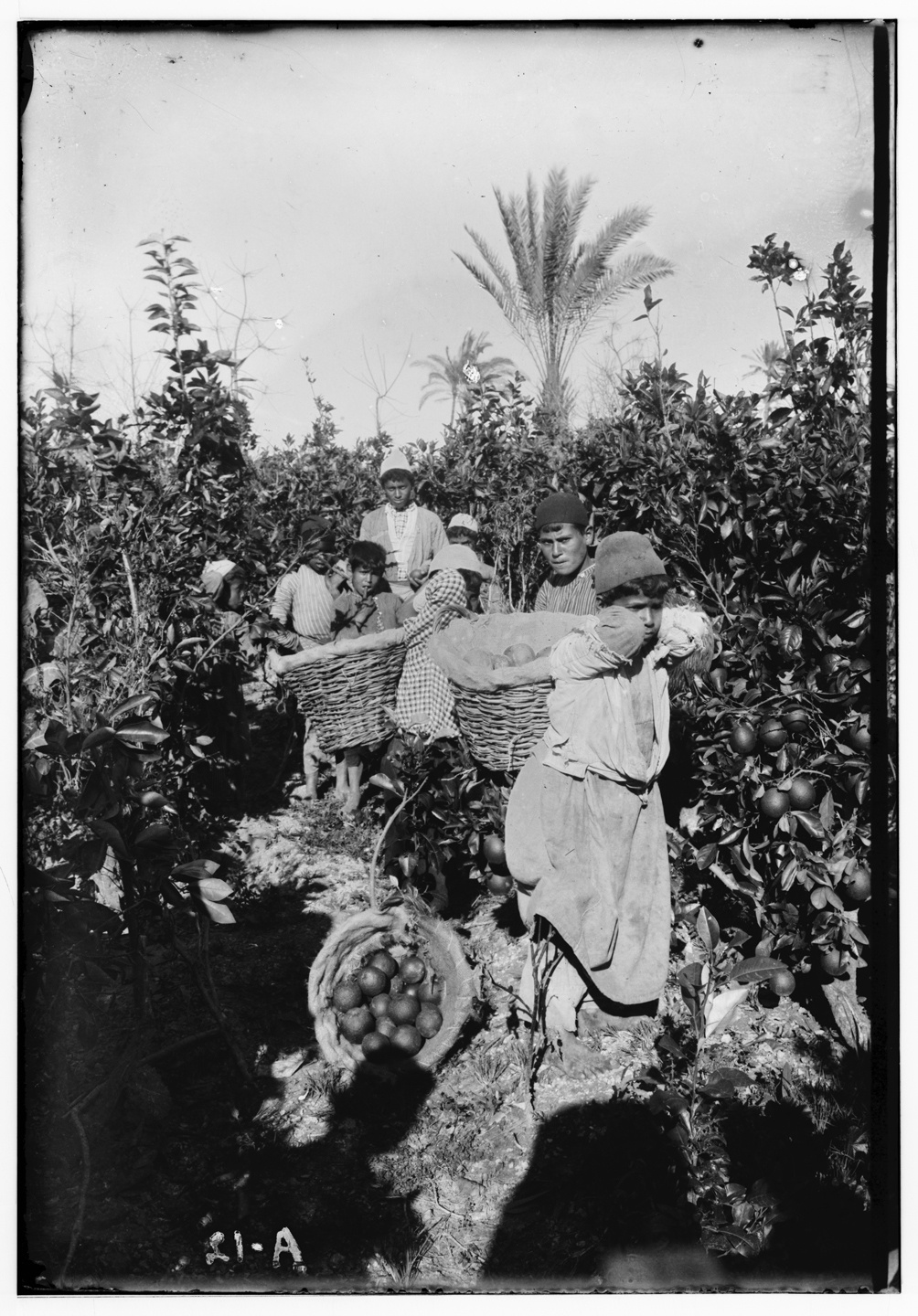
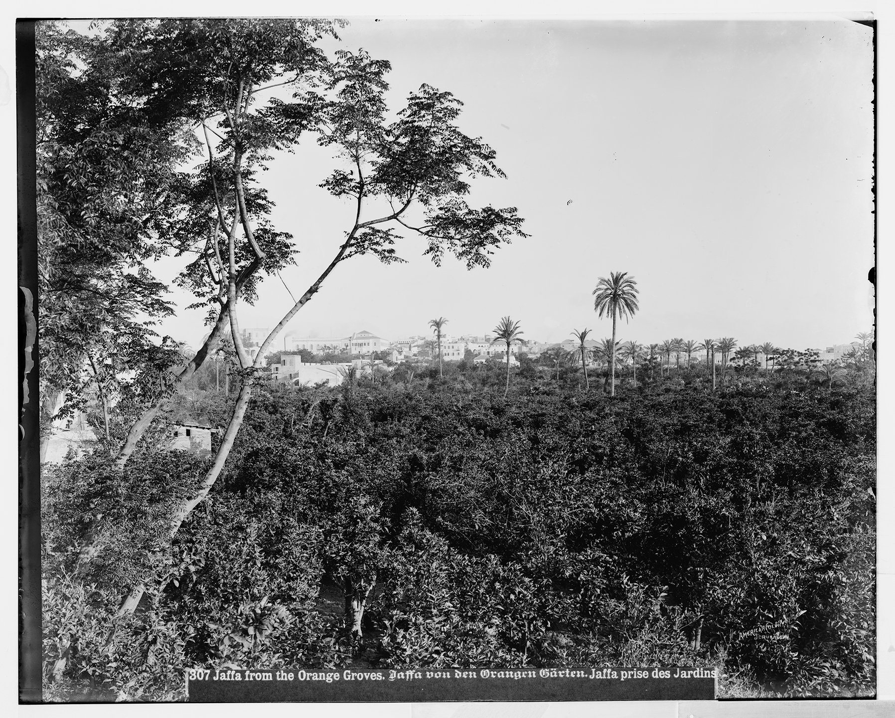
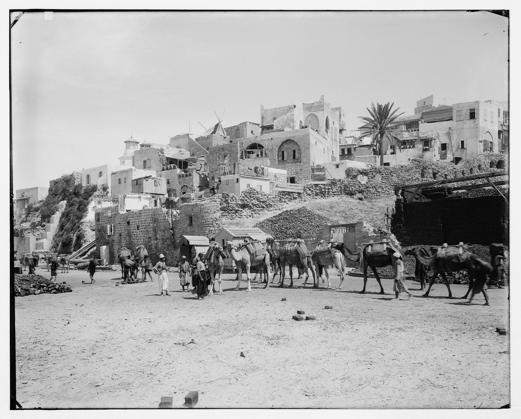
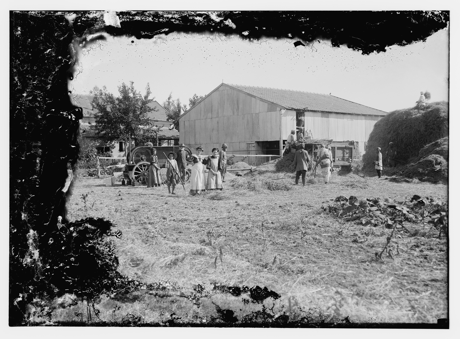
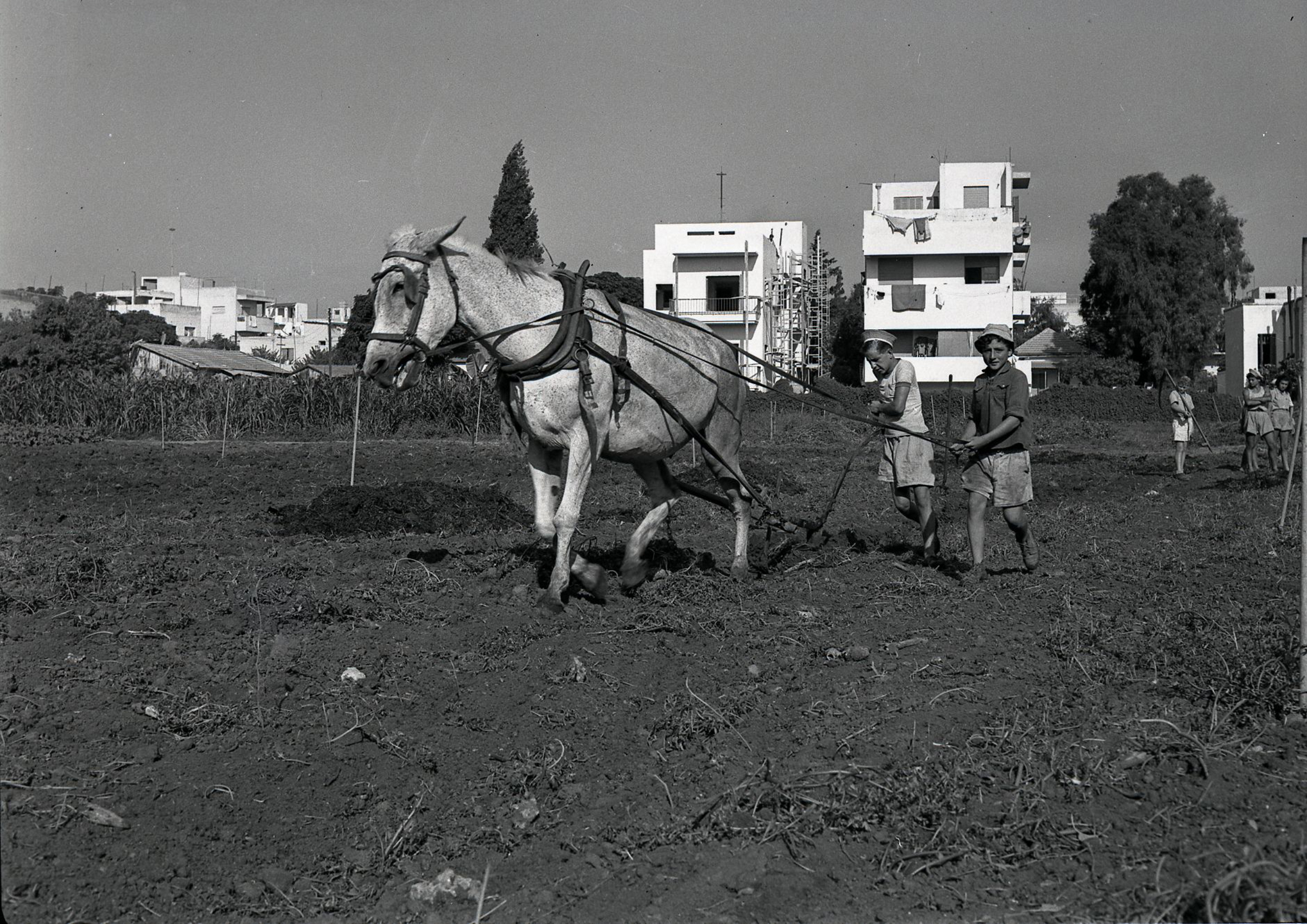
JAFFA ORANGES, including the local Shamouti landrace distinguished by its thick peel, mild flavor, and durability in transport, were developed in the mid-nineteenth century by Arab farmers in the orchards surrounding the city.
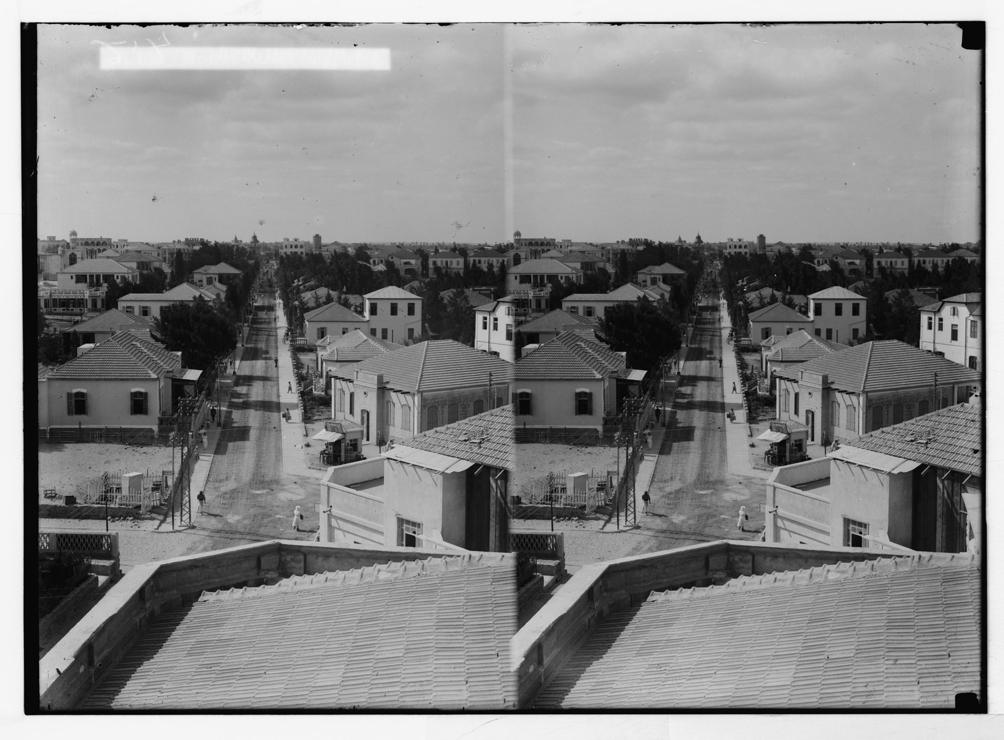
In the 1920s, Jaffa’s mixed population had reached 47,799 Muslims and Jews, alongside a smaller Christian minority. Oranges had become the cornerstone of the regional economy, fueling related shipping, banking, printing, and textile industries and linking Jaffa to global markets.
Groves extended far beyond the urban core, forming a distinctive, interwoven agrarian and built landscape.
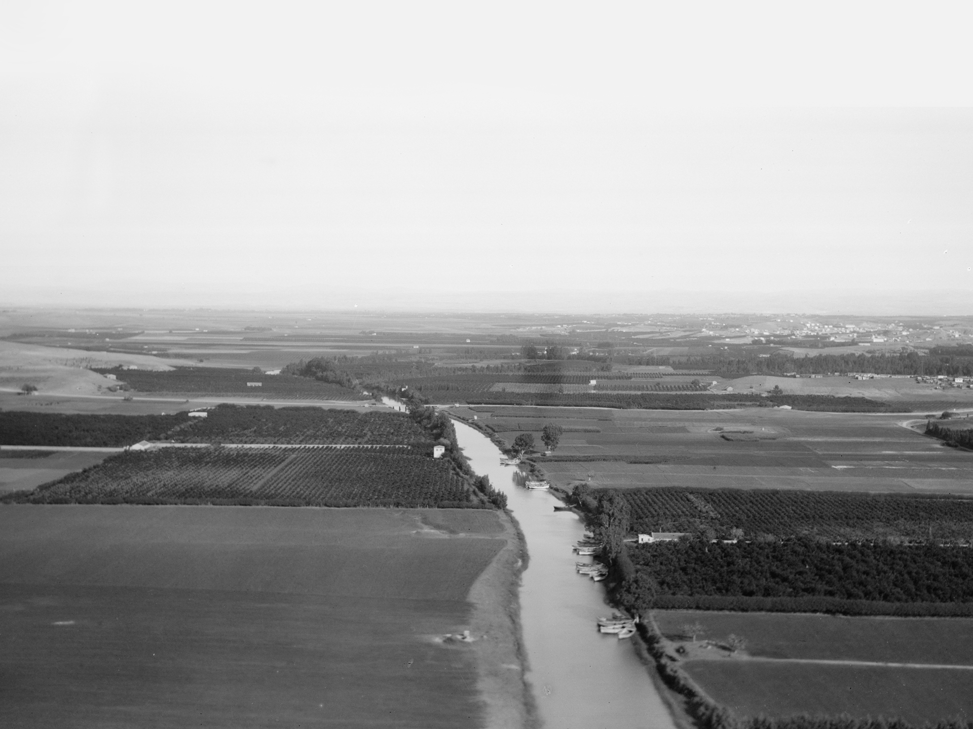
Under the British Mandate, citrus agriculture expanded dramatically, covering nearly 300 km² and employing more than 100,000 workers. Export volumes soared from 831,000 boxes in 1920-21 to 15 million cases by 1938-39, with Europe-especially the United Kingdom and Germany-serving as major markets.
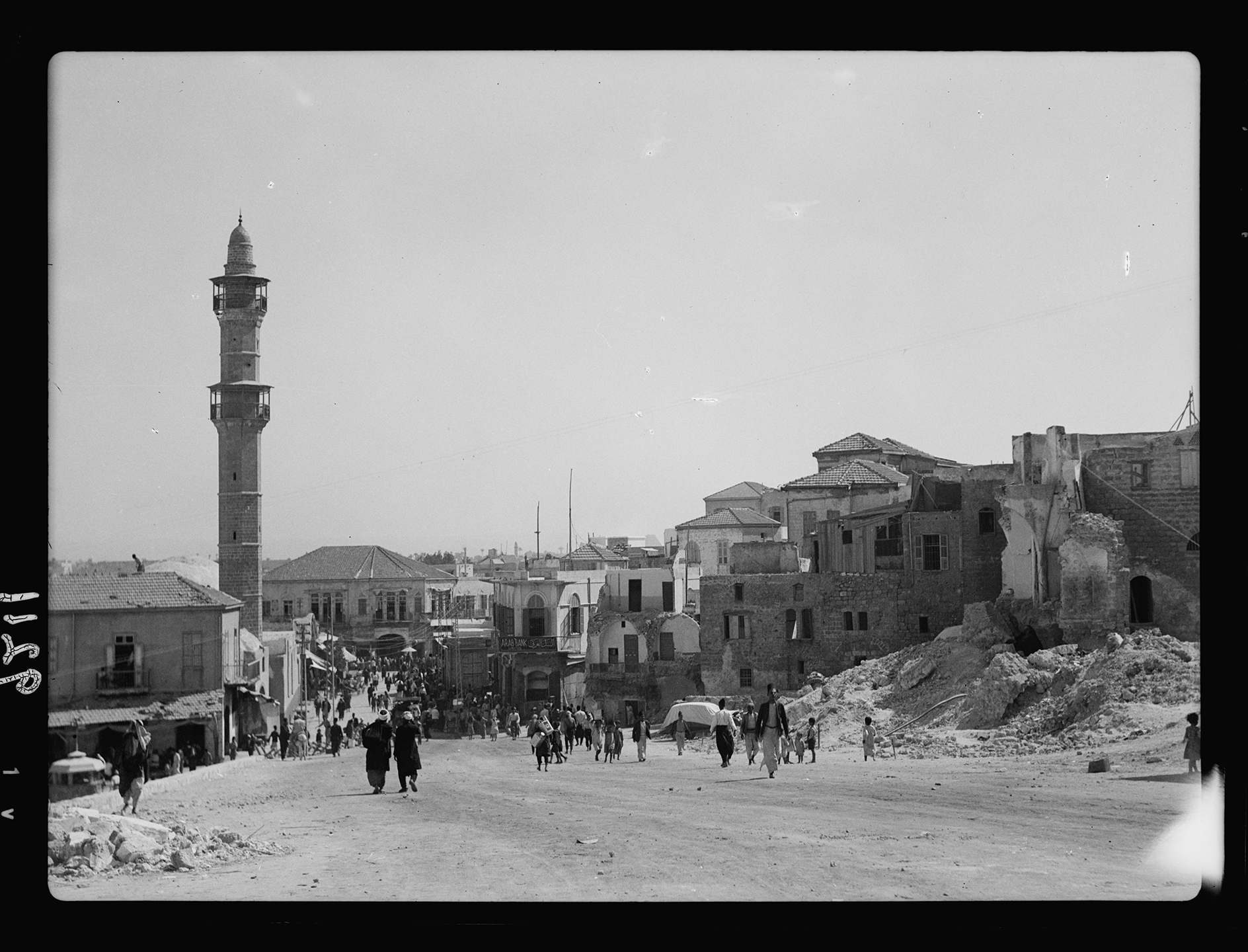
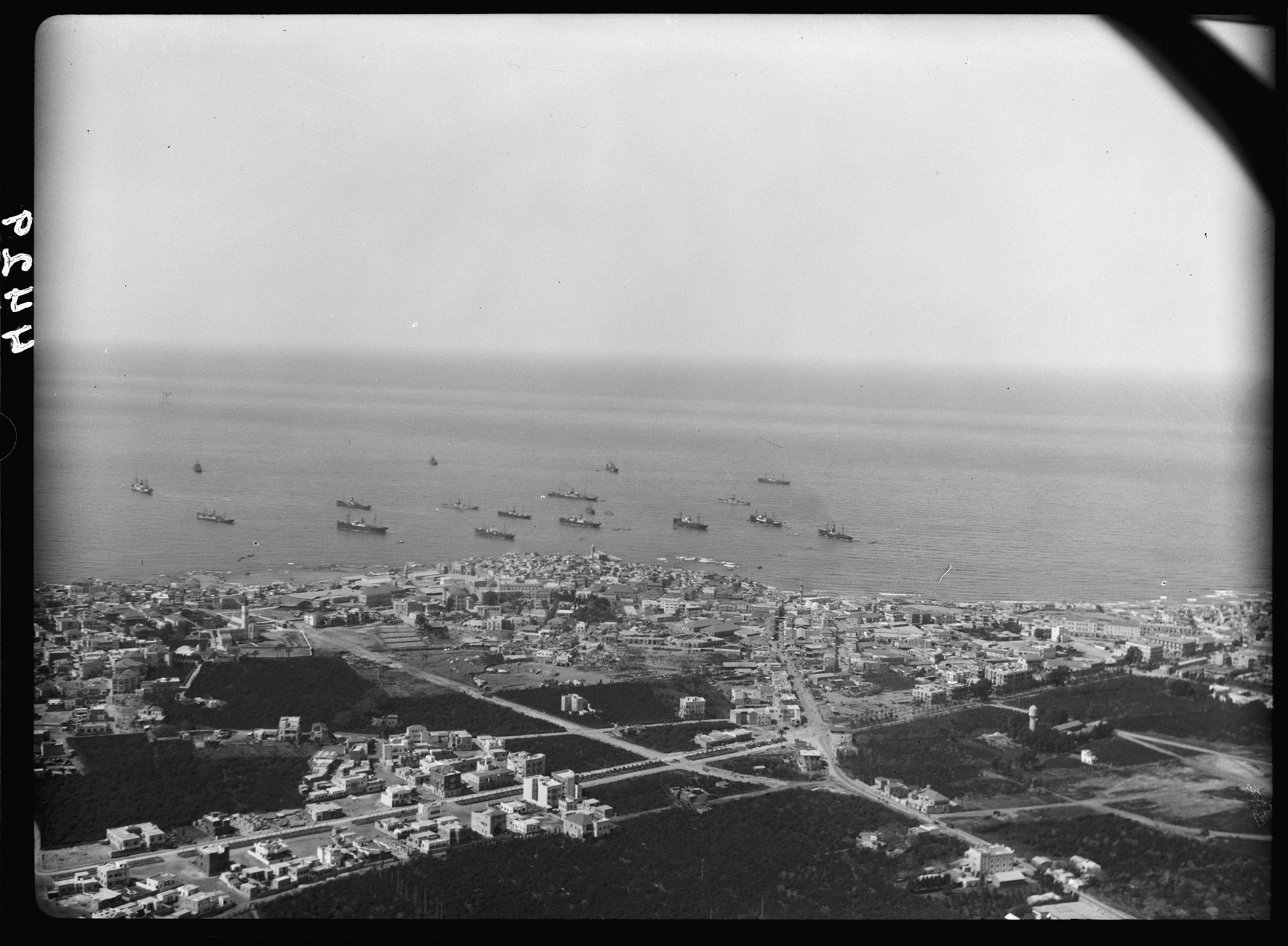
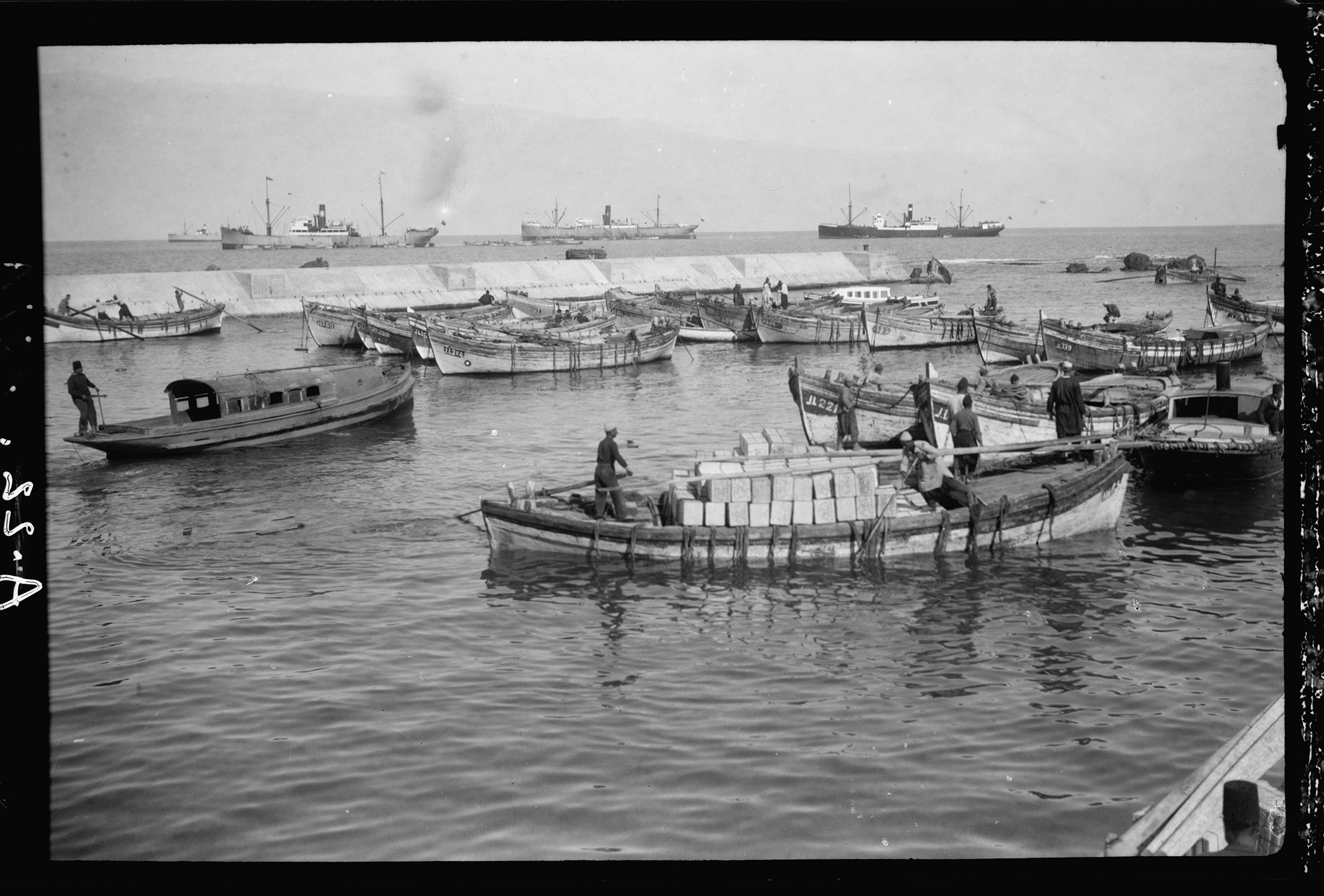
By the late 1930s, citrus exports accounted for roughly 75% of Palestine’s total export value. Jaffa remained Palestine’s leading Mediterranean port well into the early twentieth century. It served as a central hub for imports and exports, as well as an entry point for immigrants, tourists, and pilgrims.
The scenic coastline made Jaffa a destination, while its mixed population and cosmopolitan networks transformed the city into a cultural and administrative center, linking Palestine to regional and global circuits of trade, religion, and knowledge.
The first major intercommunal violence between Arabs and Jews under the British Mandate erupted during the Arab uprising in May 1921. Arab fears surrounding Jewish immigration, land purchases, and perceived threats to political and economic standing fueled the unrest and riots.
Shifts in land ownership and the rapid growth of the citrus trade intensified these tensions, amplifying economic, demographic, and political anxieties.
Jaffa’s orange culture revealed the rich potential of the interdependence between fruity-agriculture, the city, and the sea. A triad patchwork of groves, built fabric, and port infrastructure forming a co-dependent, productive landscape.
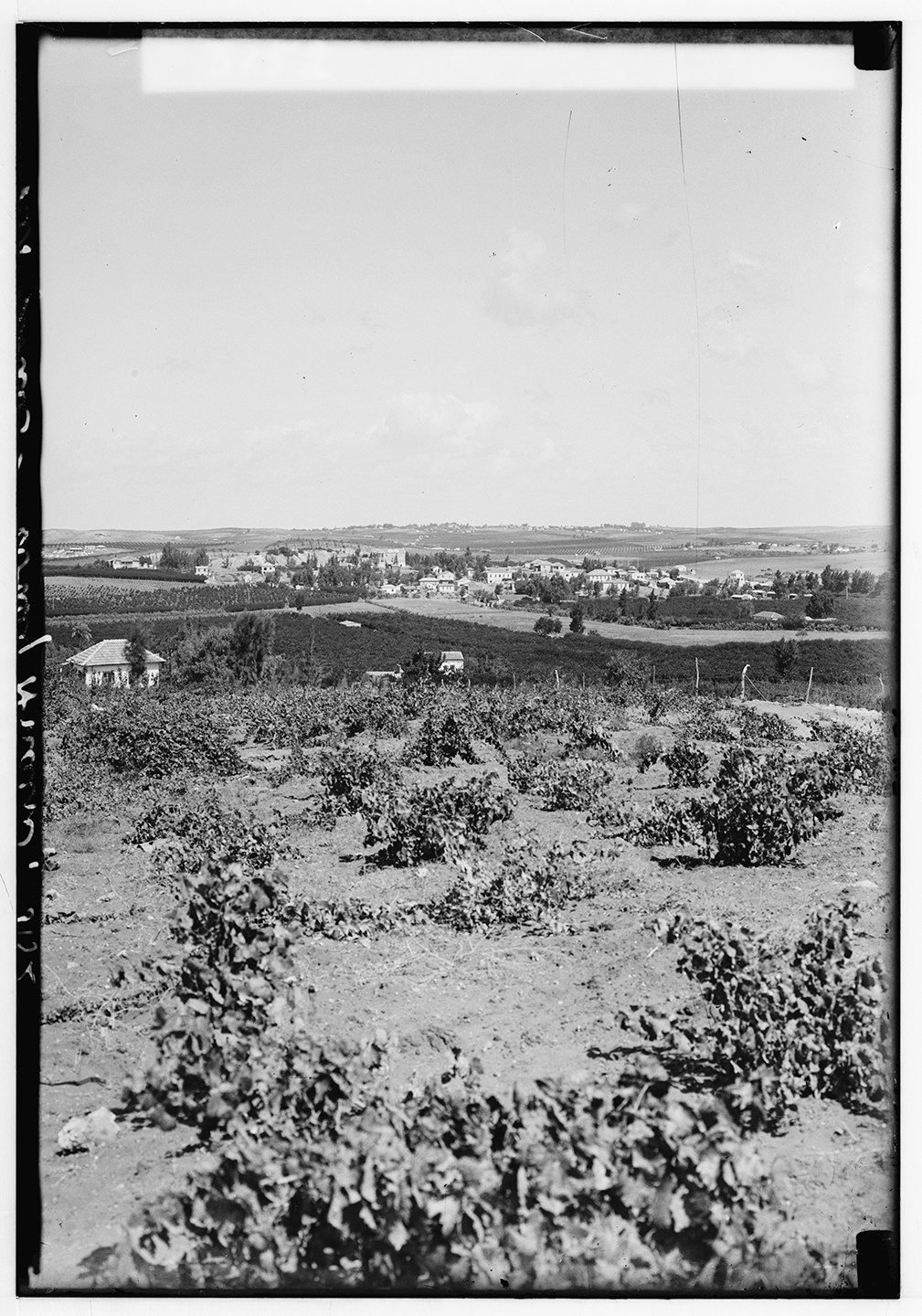
Agricultural Fields North and South of the Yarkon River.
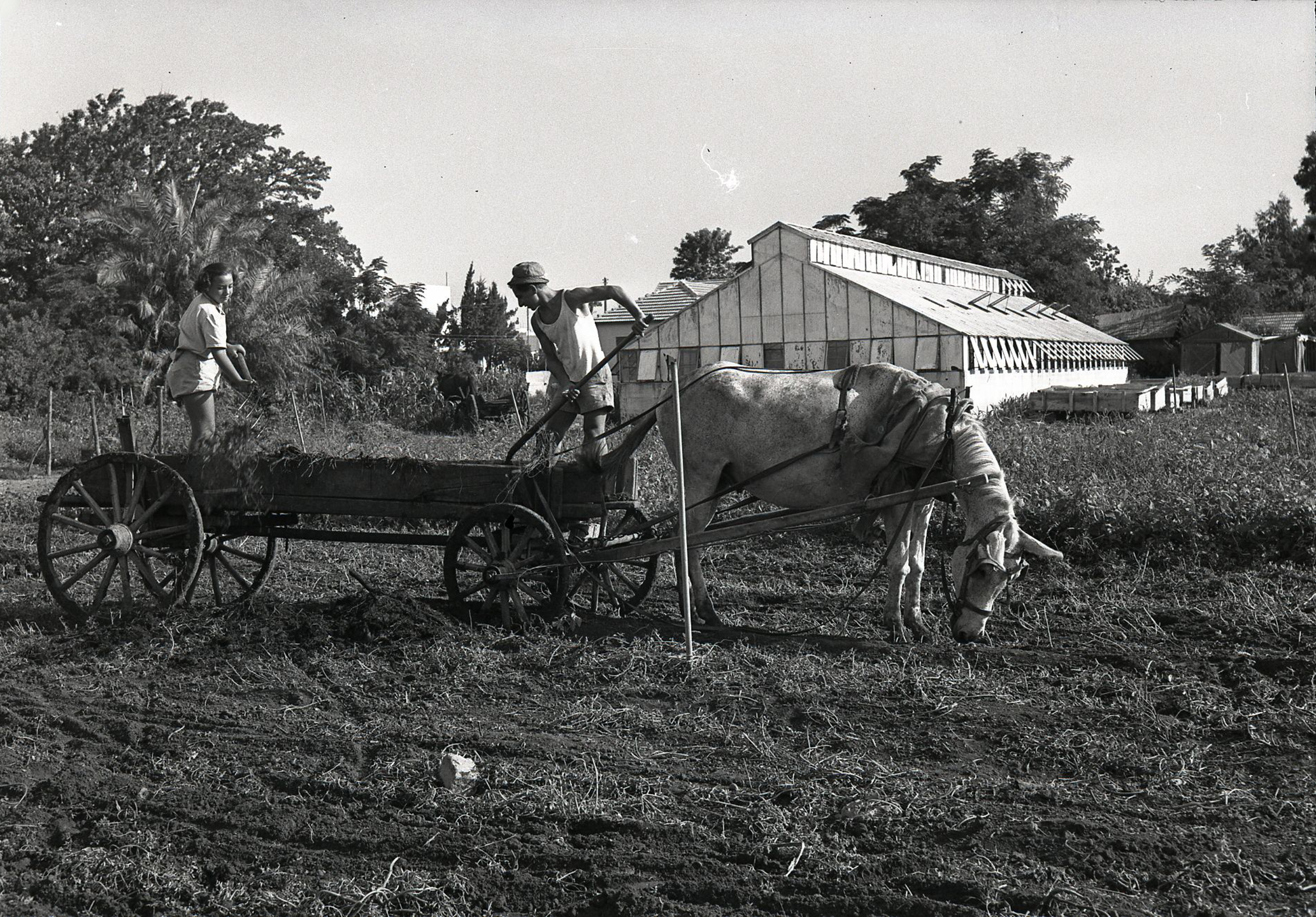
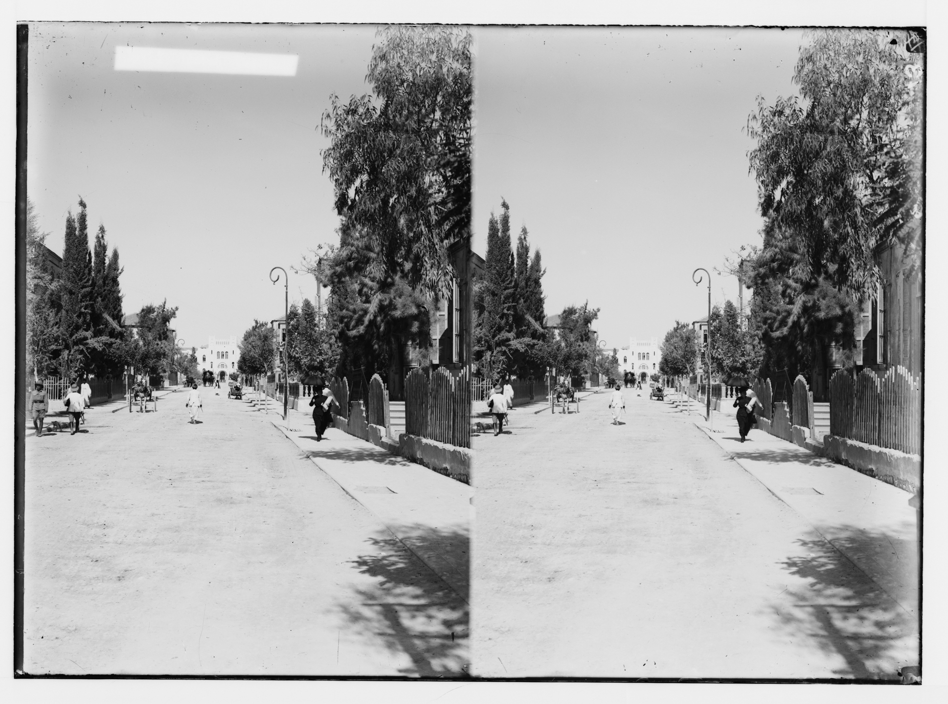
MISSION-BASED FARMING in the mid to late nineteenth century led to the establishment of numerous agricultural farms north of Jaffa, in areas that later became Tel Aviv. Together, these farms formed an active agrarian zone that remained in operation through the 1920s.
Many of these farms were founded by evangelical Christian communities seeking to mentor Jews in agriculture and hasten the coming of the Messiah.
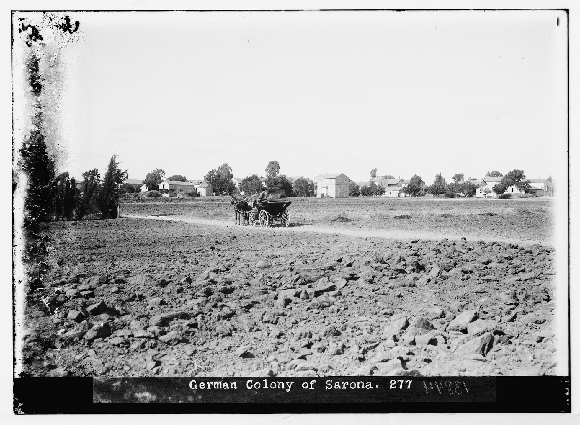
The most prominent was the Templar colony of Sarona, established in 1872, which cultivated a vast area stretching from south of the Yarkon River to Habima and east to the Ayalon River for more than seventy-five years.
Mount Hope Farm was founded in 1852 by Clorinda Minor, a member of a messianic sect from Philadelphia, on a limestone hill in northern Jaffa. The farm endured repeated attacks by local Arab residents, including looting and sexual assault.
After Minor’s death and continued violence, the site was abandoned. Its lands were sold to Moses Montefiore and later became the HaTikva neighborhood and the Shevah School.
Nearby stood Roehm Farm, whose limestone perimeter wall—now over 140 years old—still stands on Mazeh Street. Initially operated by Italian nuns, the farm was purchased in 1870 by the Templar Konrad Roehm and used for vegetable and citrus cultivation. Later managed by the Günther family, it remained active until World War II. The sale of its lands in the 1930s enabled Tel Aviv’s expansion and the construction of the first workers’ housing blocks under the Geddes plan.
A short distance away was the evangelical Model Farm, founded in 1856 by the English clergyman Alfred Isaacs. After internal operational disputes, it was sold to the Rok family. In 1921, Pinhas Rutenberg built Tel Aviv’s first power station on part of the property, while another section later became Ramat HaSharon.
Another major farm was established in 1872 on Salame Street by the Templar Georg Kapus. In 1907 it was purchased by Rabbi Shaul Yitzhak Finigstein of the Gur Hasidic community, who expanded its activities and added a synagogue, guest rooms, and workshops. The underground organization Bar-Giora was founded on the site. The farm suffered attacks during the riots of 1921 and 1929 and was burned down by Arab rioters on August 15, 1947.
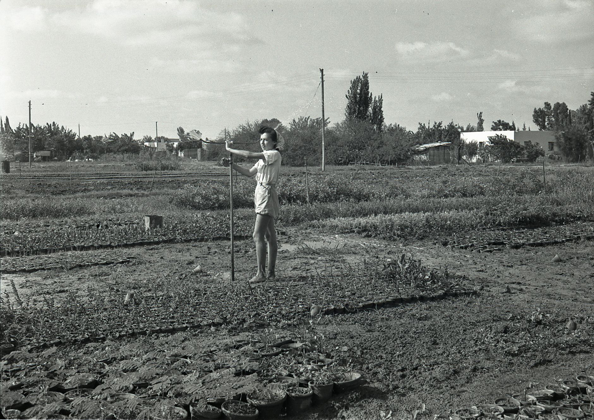
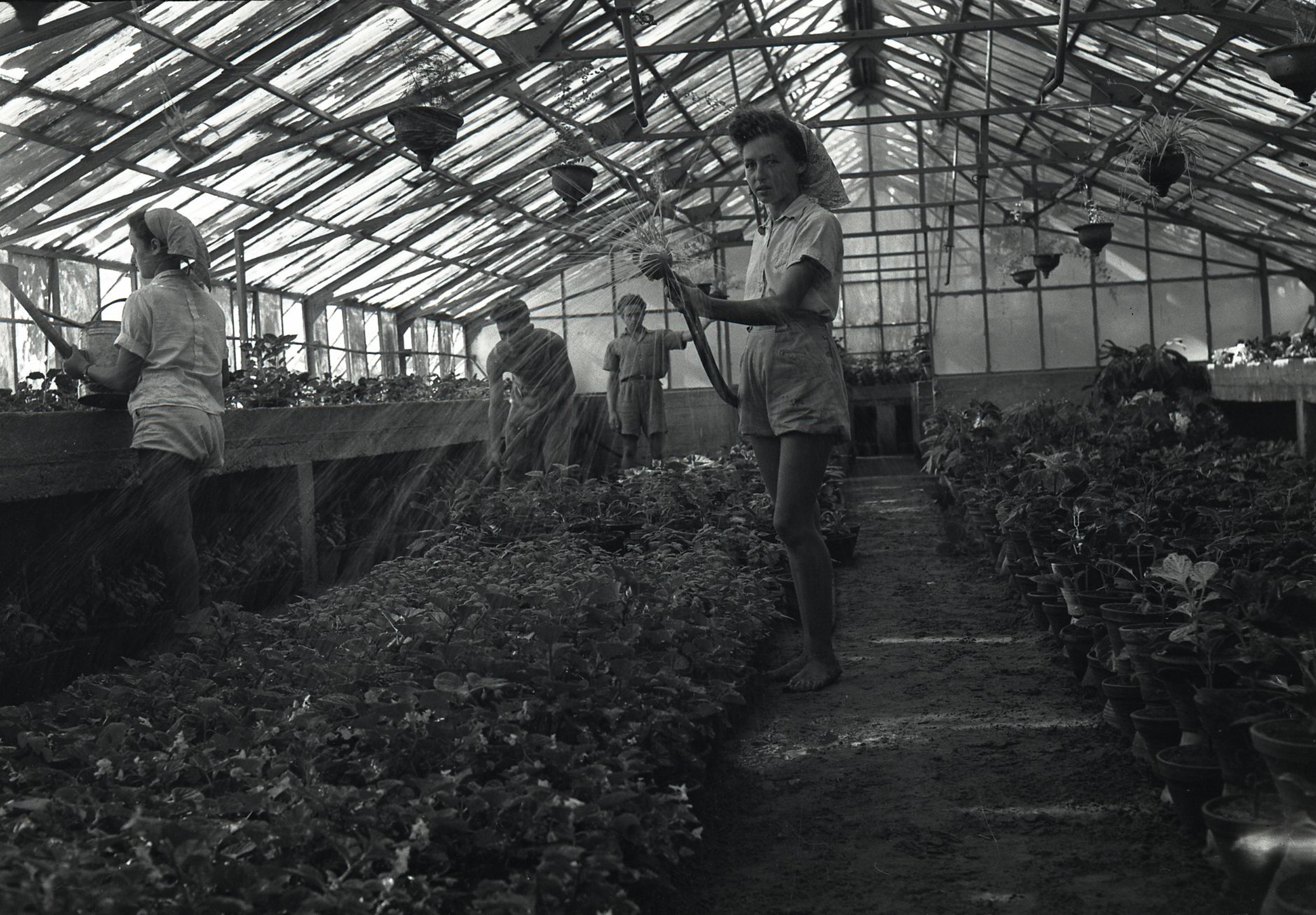
MISHKEI HAPO’ALOT, the Women’s Agricultural Estates, were established in the 1920s following the evangelical farms.
Founded by leaders of the Women Workers Movement and inspired by Hannah Maisel Shochat, these training farms integrated agricultural instruction, cooperative living, and the women’s labor movement within the growing city.
The first Meshek Po’alot farm, founded in 1924 on Aliyah–Salame Street, included extensive vegetable gardens and a flower nursery supplying the local market. Its cooperative structure provided work, income, and training for young women settling in Tel Aviv and Jaffa. The site later became the city’s first wholesale market, built directly on the farm.
A second farm, also established in 1924, occupied a thirteen-dunam site along King George Street and was managed by Zipora Baron. With vegetable gardens, a nursery, and a poultry yard, it became one of Tel Aviv’s earliest examples of urban agriculture. The farm operated until 1927 and was later transformed into Beit HaHalutzot, alongside the creation of Gan Meir.
The third farm, founded in 1925 at Arlosoroff and Adam HaCohen Streets and managed by Hannah Chizhik, focused on dairy production alongside vegetable gardens and poultry. Known as Beit Hana, it supplied much of Tel Aviv’s milk during the city’s early years of rapid growth and operated until 1929, playing a central role in agricultural education and fostering cooperative community life.
Together, the Women Workers Farms cultivated women’s leadership, economic independence, and new, more equitable social models. By embedding agriculture within the city, they left a lasting imprint on both Tel Aviv’s urban fabric and the history of the women’s movement.
Mission-driven agriculture offered a living model linking work on the land, communal life, and civic formation—a vision reflected in Tel Aviv’s early agro-urban landscape, much of it shaped and managed by women.
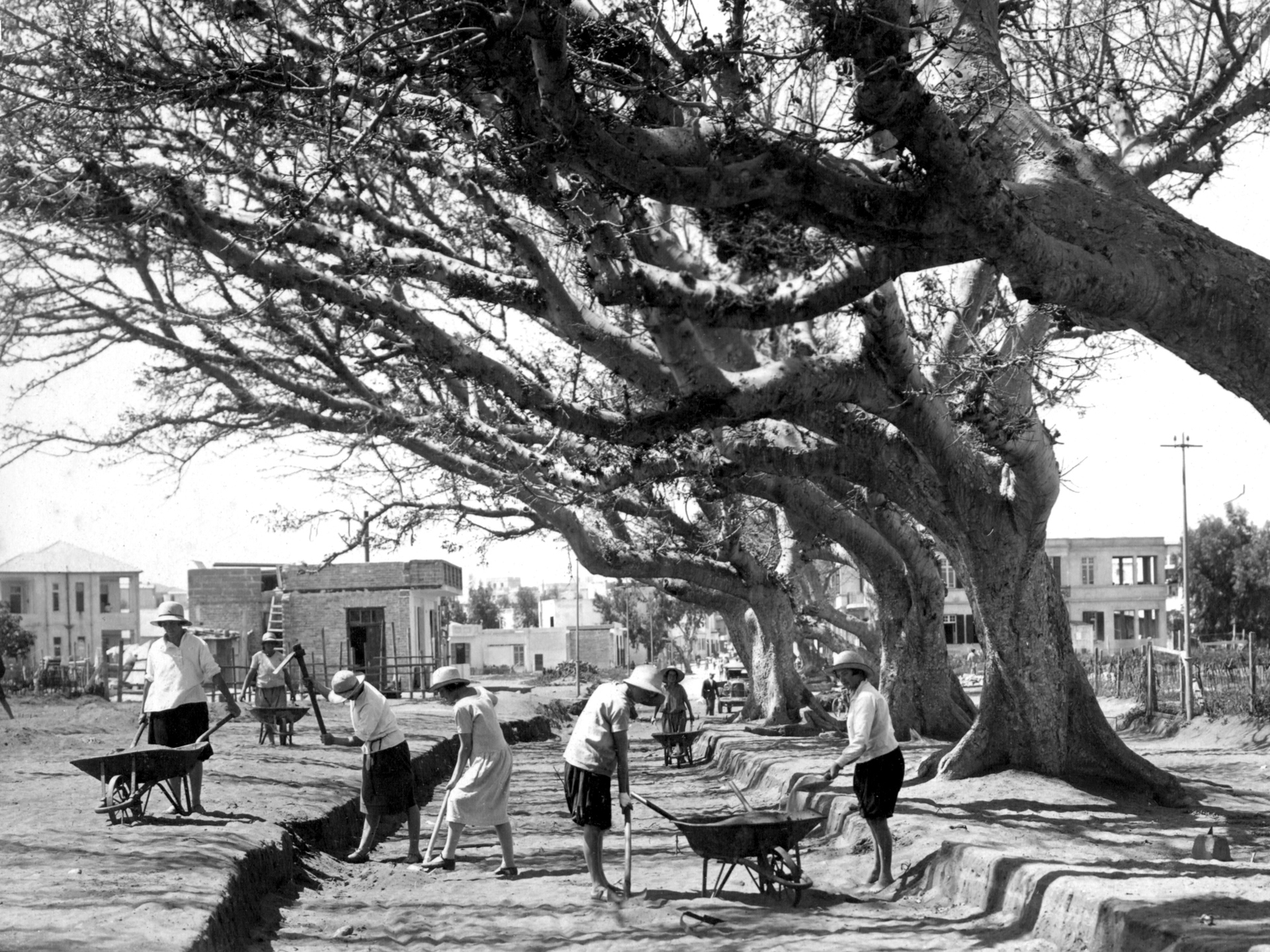
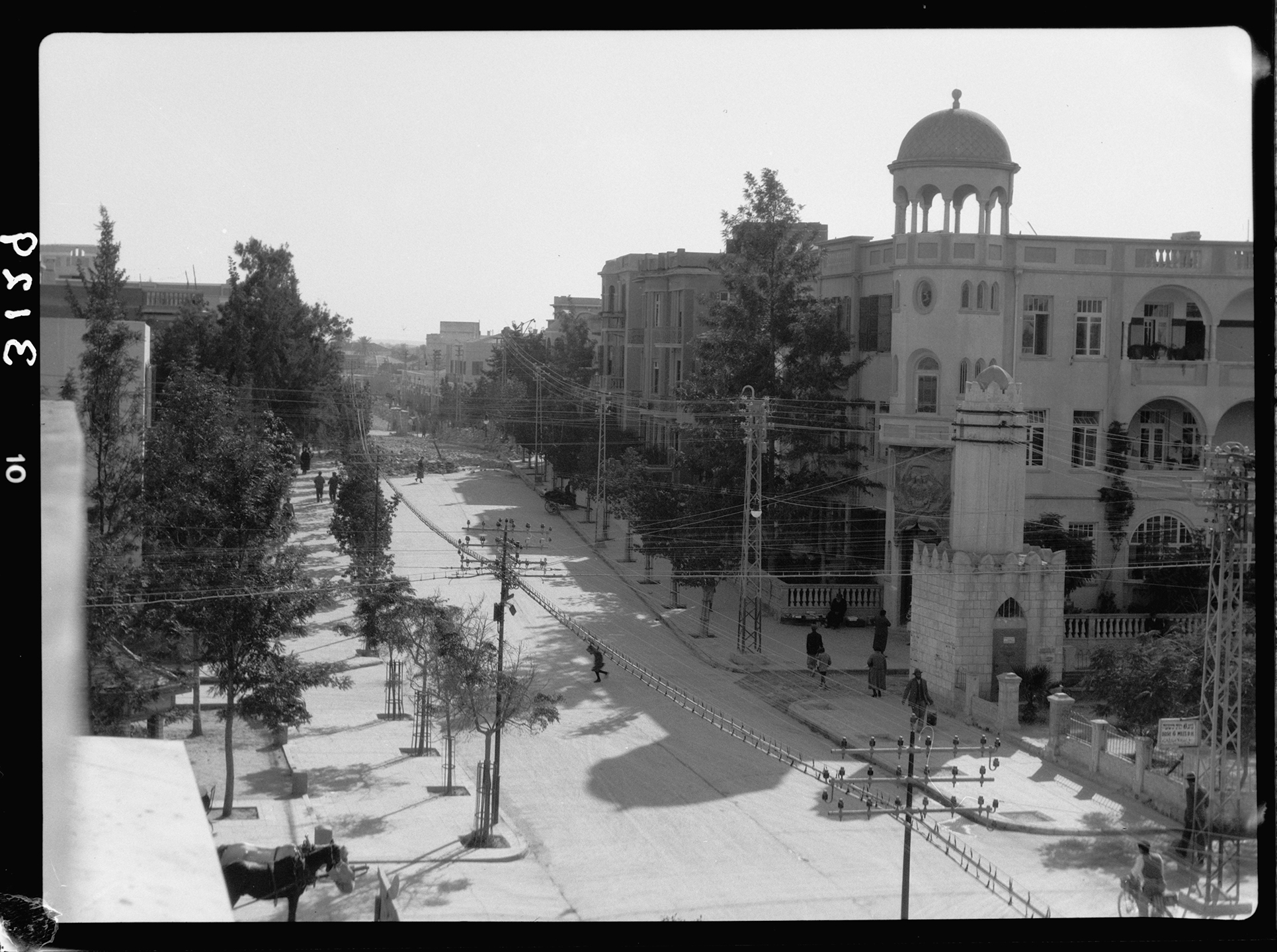
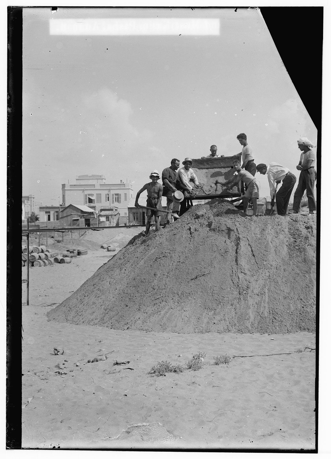
King George Street, Women Paving the Road Alongside a Row of Sycamores, Tel Aviv, 1923.
HACHSHARAT HAYISHUV, founded in 1909 as the Zionist movement’s development company, played a central role in shaping the land on which Tel Aviv emerged.
Focused on land acquisition and development, it purchased and consolidated parcels and prepared them for settlement.
Working alongside the Jewish National Fund, it facilitated independent Jewish urban expansion north and east of Jaffa at a time when dunes and orchards were just beginning to be transformed.
The city’s origins trace to the Ahuzat Bayit association, a cooperative of sixty-six families who purchased plots from the residents of Summayl that same year. With legal and financial support from Hachsharat HaYishuv and JNF-backed loans, the group laid out streets, installed electricity, dug wells, built drainage systems, and coordinated one of the city’s earliest organized infrastructure projects.
The JNF secured key parcels for public spaces and neighborhood gardens, reinforcing a commitment to parks, institutions, and civic amenities within the city’s early plan.
Trees were planted along streets and in private lots, an intentional act of place-making within the sandy landscape, while Rothschild Boulevard became the city’s first public space.
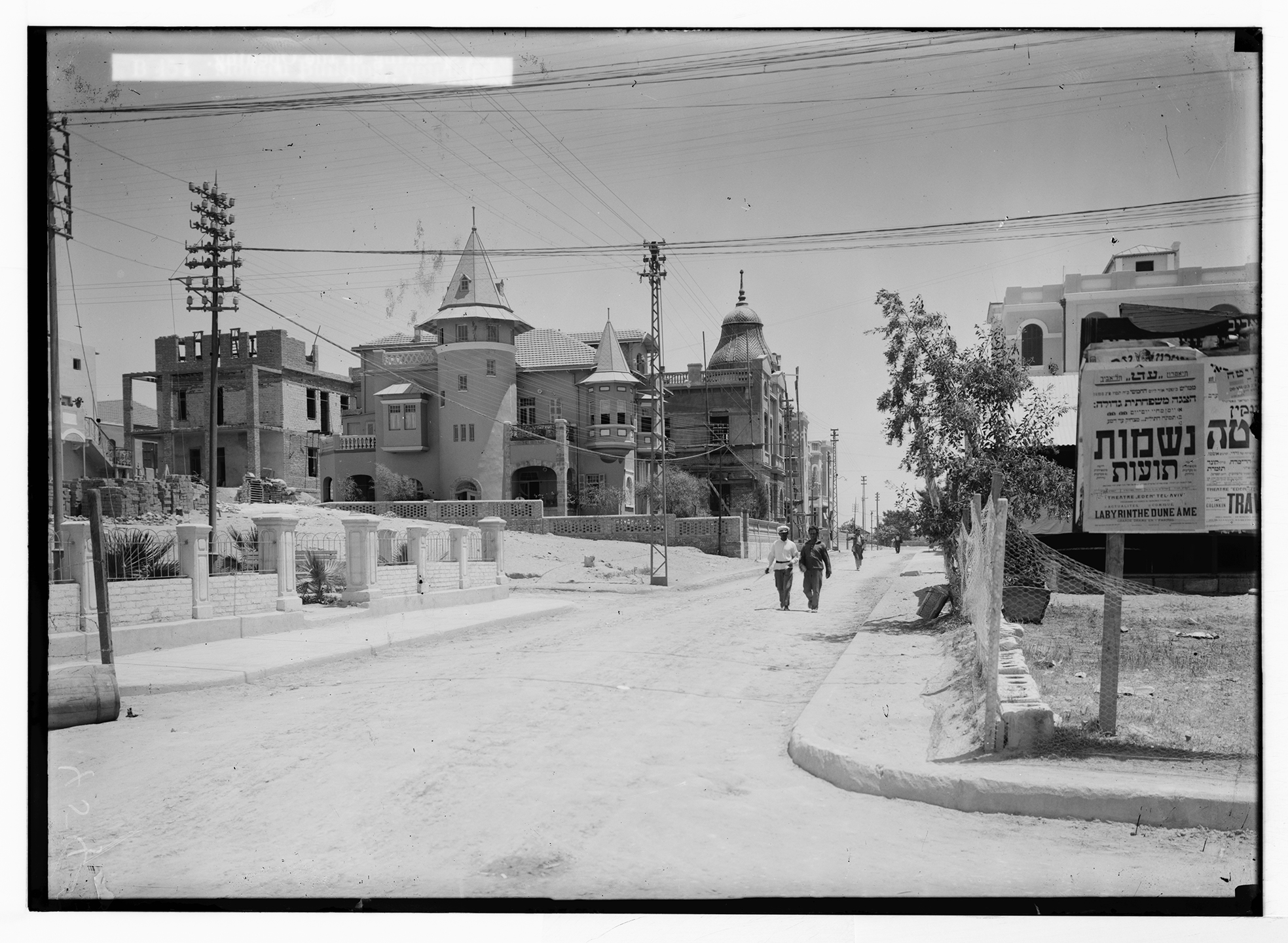
At its heart stood the Herzliya Gymnasia, a cultural and educational institution that, for a time, attracted international students. Its construction involved communal labor and collective fundraising, exemplifying the civic participation that defined early Tel Aviv.
As housing demand grew, Hachsharat HaYishuv expanded the urban territory, acquiring additional tracts: the Allenby parcels, which became a commercial spine linking Jaffa to the new city; lands in Nordia and Montefiore; and areas stretching toward the Yarkon River, intended for worker housing and residential neighborhood expansion.
By the time Patrick Geddes arrived in 1925 to propose a master plan, Tel Aviv was already a mosaic of individually owned plots, cooperative holdings, institutional lands, and former agricultural estates.
Geddes’ plan was possible because Hachsharat HaYishuv and other Zionist land companies had already aggregated, financed, and consolidated much of the city under institutional ownership.
They created a surveyed, tractable landscape with large parcels, for future super-blocks, ready for subdivision into blocks and lots made accessible for purchase by Jewish immigrants, coordinated by the development institutions that preceded him.
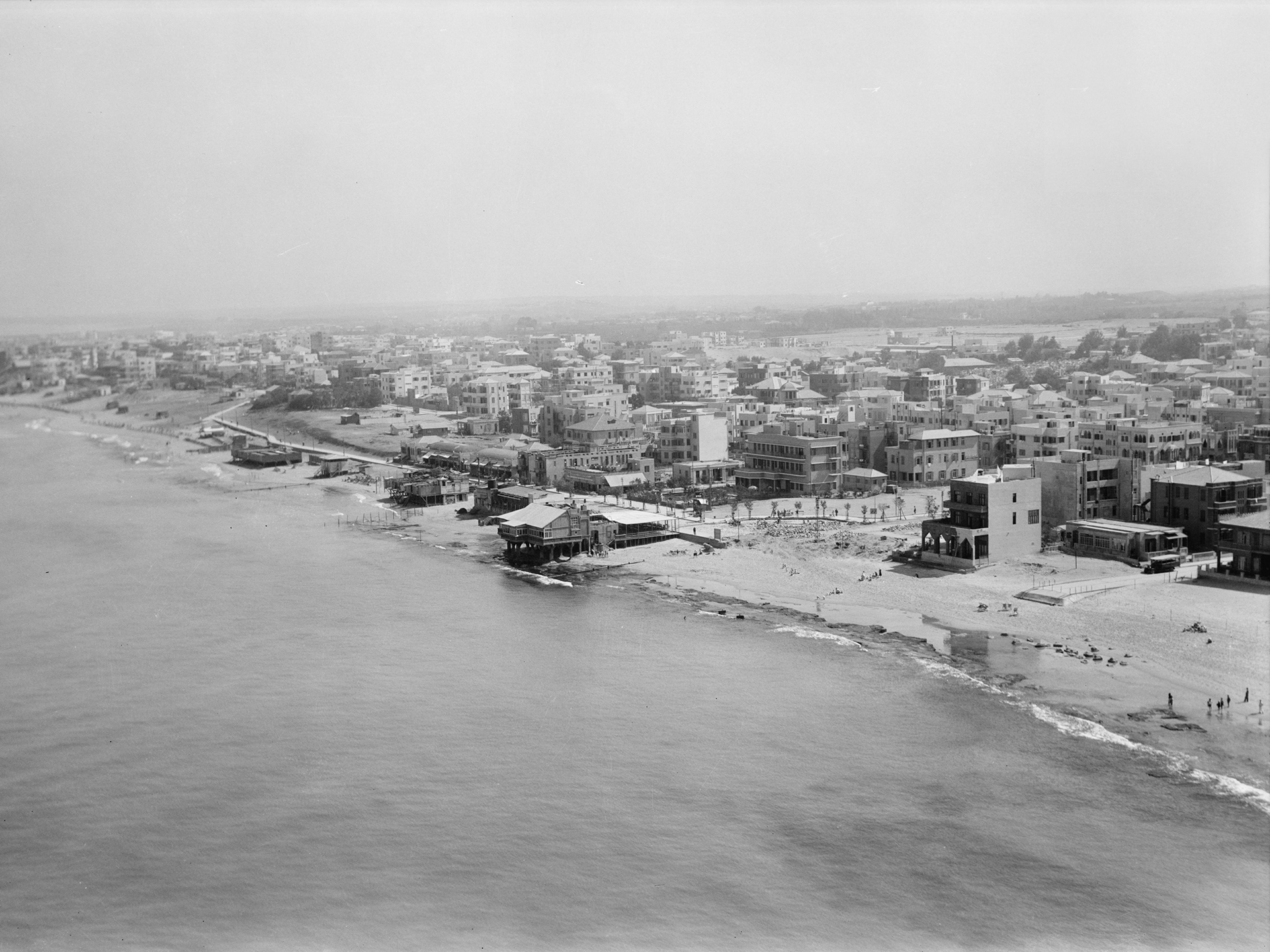
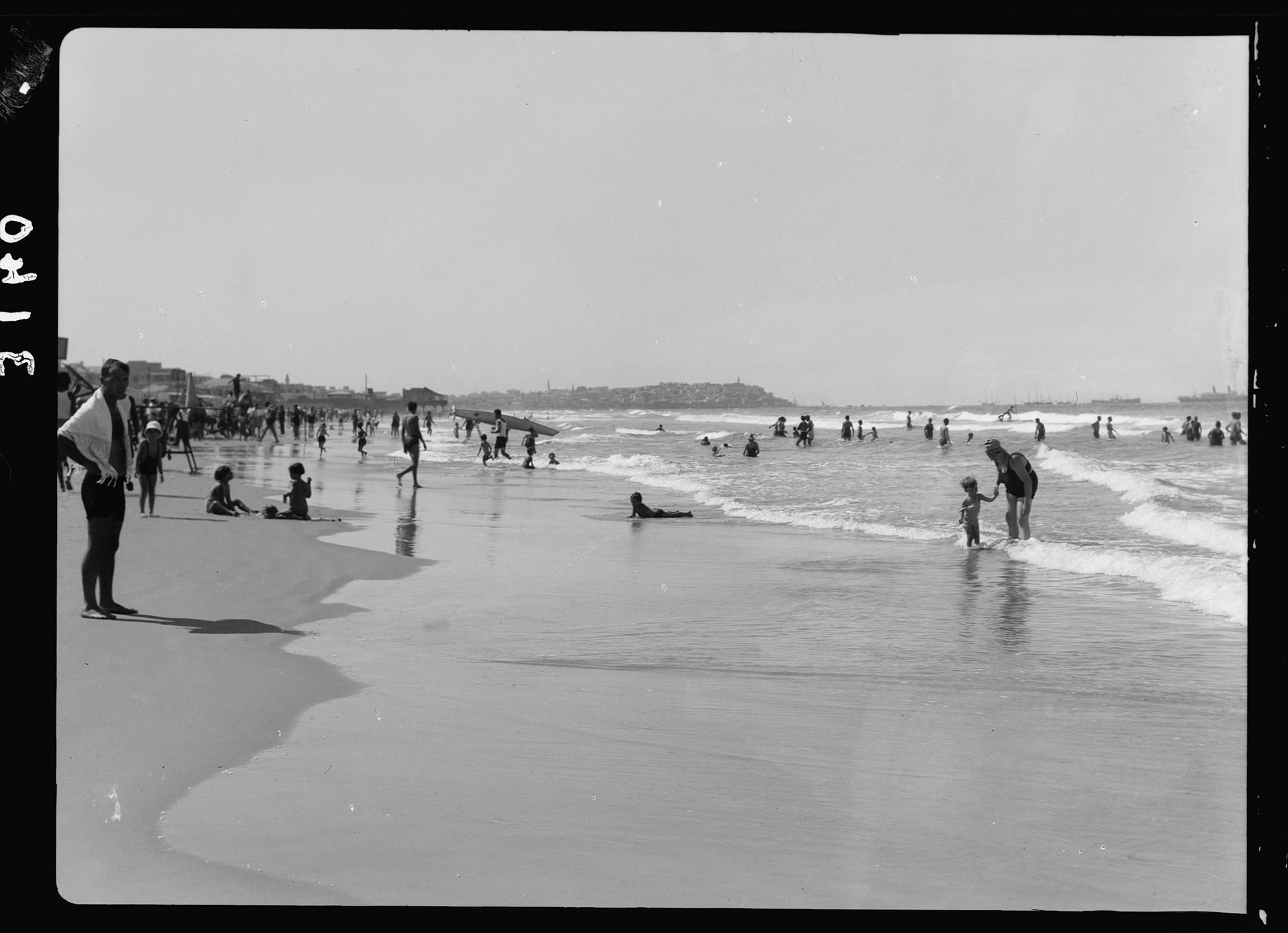
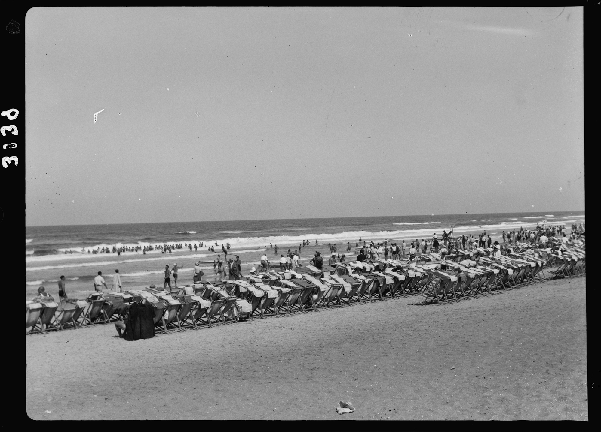
Casino and Bathing Beach, Tel Aviv.
TEL AVIV BEACH TOWN: In the 1920s and 1930s, Tel Aviv’s shoreline became a defining arena of hedonism and imperial presence along the Mediterranean.
Early bathing beaches—Havatselet, Nordau, and Jerusalem (Geula)—fostered an unbuttoned, informal body culture. Mixed bathing grew increasingly common, and the beach emerged as a central site of the city’s relaxed, liberal, and decadent character.
Alongside this seaside culture, the waterfront Casino rose in the early 1930s, its open-air terraces hosting dancing, music, and social gatherings. Artists, intellectuals, and young urbanites flocked there, seeing in it a glimpse of Tel Aviv’s cosmopolitan aspirations.
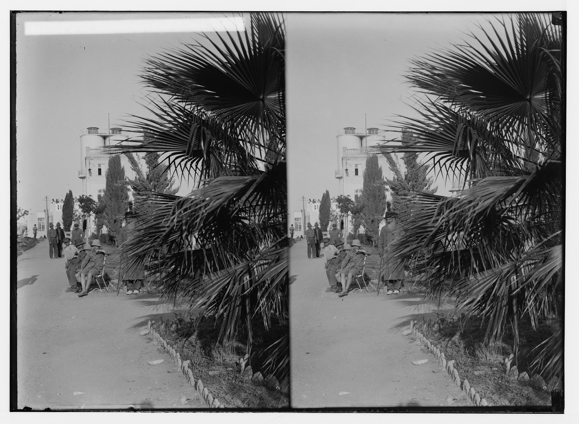
During the British Mandatory period, soldiers became a familiar presence along the beach, their uniforms, accents, and colonial traces reflecting the promise and tensions of the political moment.
Further north, the Exhibition Grounds, home to the Levant Fair of 1932 and 1934, introduced international architecture, trade pavilions, and maritime events to the shoreline. Visitors arrived by boat, crowds gathered along the beach to watch naval displays, and the fair’s iconic flying-camel emblem cast the coast as a gateway to modernity and Eastern Mediterranean commerce.
Built during the 1936 Arab General Strike to counter the closure of Jaffa Port, the Tel Aviv Port transformed the northern waterfront into a working harbor. Cargo boats docked along the jetties, workers unloaded goods, and new immigrants disembarked under British supervision. Warehouses, cafés, and workshops clustered around the docks, blending maritime industry with the city’s evolving coastal life.
Tel Aviv’s waterfront embodied the essence of the beachtown: a Mediterranean frontage with leisure always on the horizon.
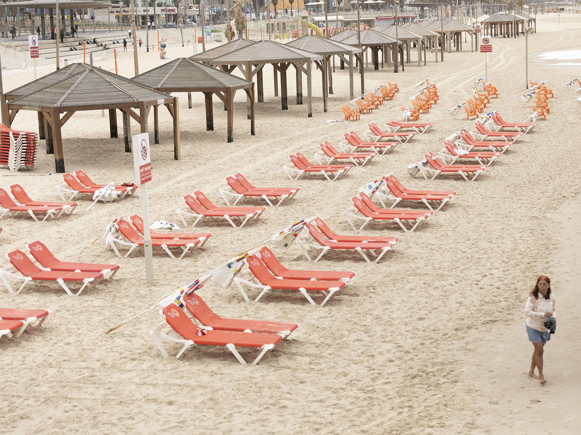
1918-2021 BEACH CHAIRS, the rhyme of history. In the wake of the 1918 influenza epidemic, city planning emphasized decongestion, lower densities, improved ventilation, and single-tract standalone housing surrounded by green—shaping the early modernist garden city and driving suburbanization.
A century later, in the midst of global urbanization, COVID-19 forced cities, including Tel Aviv, to rethink public spaces, workplaces, housing, commerce, liesure, mobility, supply chains, and behavioral design.
Fronting the same sea.
Gardenicity Curation, Design, Writing, Media:
Megama/Rebecca Sternberg, Keren Avni
Photo Credits:
1 – Survey of Israel (MAPI)
2–9, 15-25 – Matson Collection
10 – Younes and Soraya Nazarian Library, University of Haifa
11–14 – Boris Carmi, National Library of Israel
26 – Tomer Appelbaum
What Did Geddes See?
Civic Green
Growth
Sustenance
Leafy SDGs
HE/עב
Supported by The Pershing Square Foundation